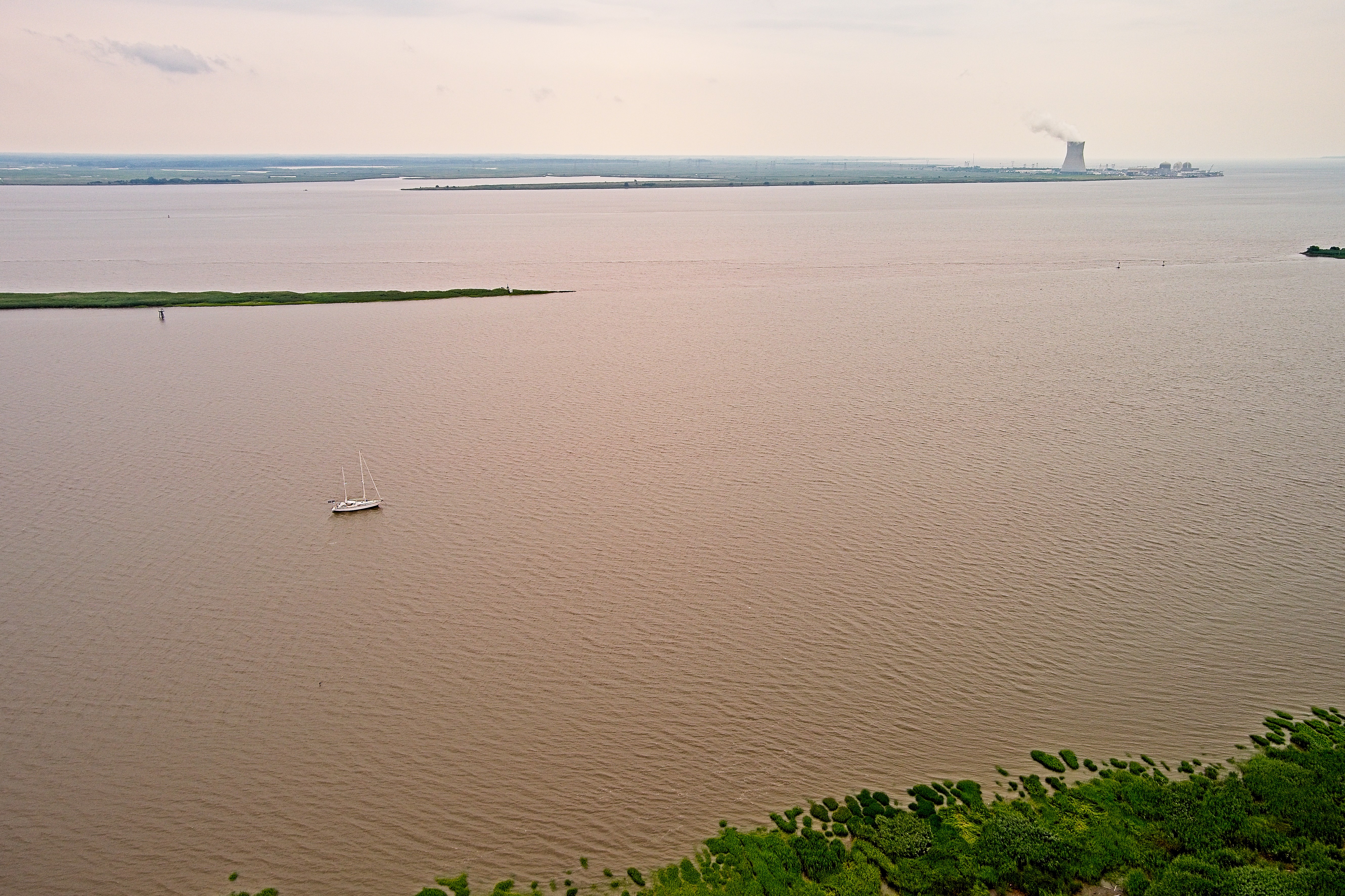
Yesterday afternoon we were at anchor off Reedy Island in the Delaware, waiting for the passage of a cold front before we continued down the river toward Delaware Bay.
This does not look like fun…
What looked very dramatic on the approach wasn’t too bad in actual fact. Winds did not get over 28 knots or so, and lightning was very scattered. Rain was extremely heavy for a short time. A few miles to the southwest of us reported waterspouts, hail and gusts to close to 40. As this system passed over us, the air temperature dropped 15 degrees in 20 minutes, and the wind shifted 180 degrees. Setting us up for a much nicer ride the next morning.
Our trip down river was easy, and quite quick. It is about 9-1/2 hours, so you can not ride a favorable tide the entire way, but we did make the most of it, anchor up at 10:30, and anchor down in Breakwater Harbor at 20:00. Motoring for the entire trip was limited to 45 minutes in total for maneuvering at the beginning and end.
We had a peaceful night at anchor, and today is cool, breezy and sunny. Cool enough it does not make a great beach day, but just delightful to hang out.
Late this afternoon, we will be anchor up, and headed out to the ocean. Our first destination will be about 70 miles to the southeast, at the very edge of the continental shelf. A the “canyon” is 1000 foot deep notch in the underwater geography where fish of all kinds congregate. We hope to leave for points north with a few of those fish in our freezer 🙂
Our next planned stop after that will be Provincetown, out on the end of Cape Cod, although intermediate harbors might call out for our attention.
Harmonie anchored in the Delaware River at Reedy Island
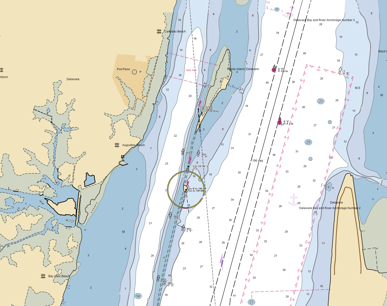
It is difficult to time the tides on the Delaware River, the Chesapeake & Delaware canal, and the Chesapeake Bay so that you can easier make the trip in one go on a slow boat. So it is nice to have anchorages on both sides of the Canal to break up the trip. There are many options on the Chesapeake side with Worton Creek and the Sassafras River being prime choices. It’s a different story on the Delaware side of the canal. There really is only one anchorage available about 3 miles south of the C&D Canal at Reedy Island.
Anchor between Reedy Island and the Delaware shore in about 20 feet. Good holding in firm mud.
A bit of interesting history here. From the beginning of the 19th Century up to the end of WWII this was the quarantine stop for ships headed to Philadelphia. An inspection station and hospital were on the island. Any vessel infected with cholera, yellow fever, tuberculosis, plague or small pox would be disinfected. Steam was used to sterilize clothing, sulfur dioxide gas was piped into ships, and if anyone was sick, everyone was quarantined until they were considered no longer contagious. Not surprisingly, looking at the island today all the buildings were elevated on pilings and connected by elevated boardwalks to stay above the highest tides. When the island was abandoned, several of the buildings were moved to the small village of Port Penn on the Delaware shore.
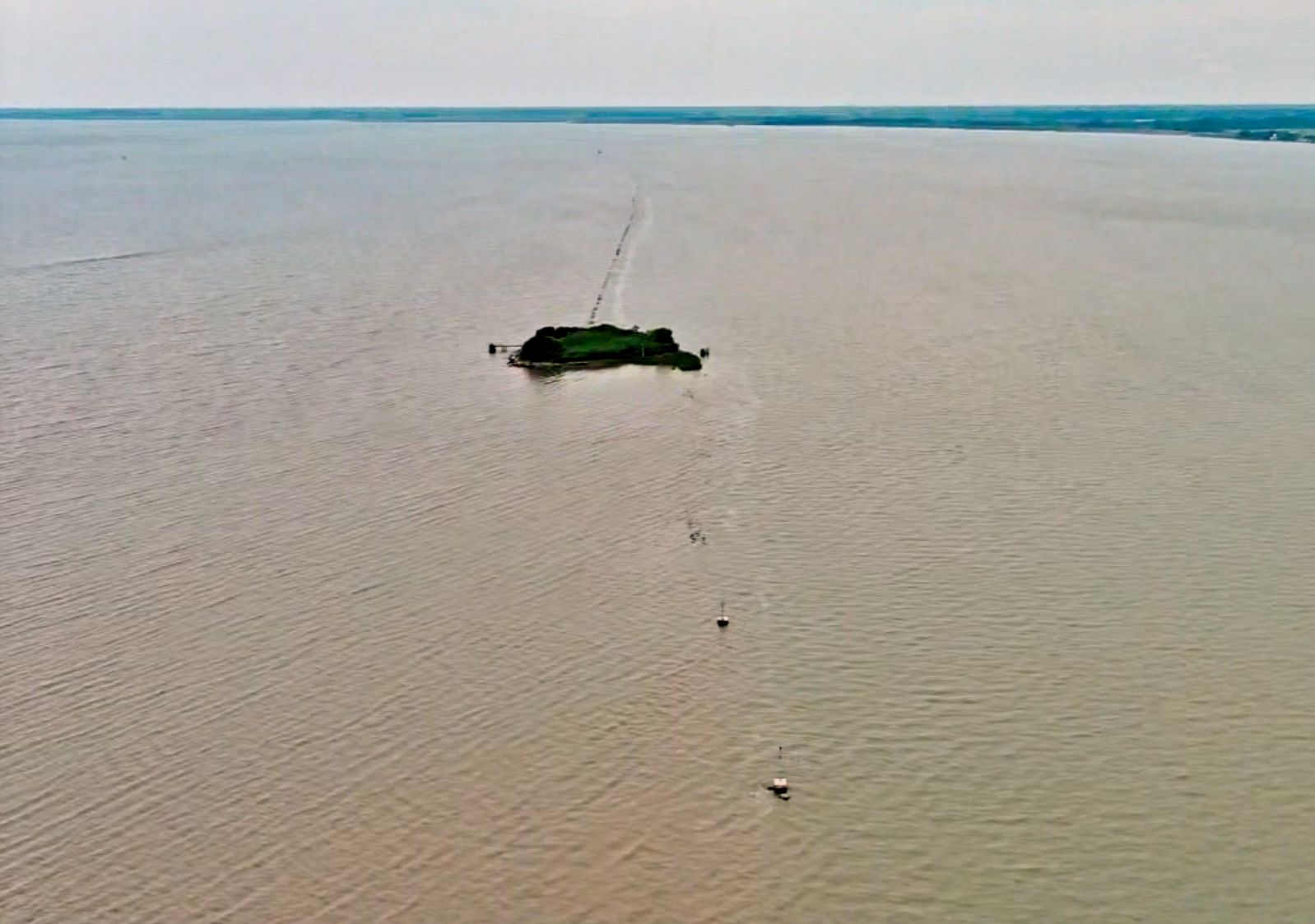
Other than its history, the anchorage would be completely unremarkable, except for “The Dike”. Extending south from Reedy Island for a distance of about 3 miles is a stone jetty. Exposed at very low tides, most of the time this rock wall is submerged, barely. Over the years the rocks have claimed propellers, rudders, and hulls of several boats that were either ignorant of the danger, or just inattentive.
The anchorage can be approached by boats with shallow draft from either the below the southern end of the dike, or around the north end of Reedy Island. Deeper draft boats have to use the marked gap in the dike just south of the island. There is a red beacon on the north side, and a green daymark on the south. This entrance has a minimum depth of about 12 feet, and a width of about 100 feet. The markers are actually on the ends of the dike itself, so don’t cut the corner! Be careful on the approach when the tide is running strong. In the cross current an inattentive captain could be set on the rocks.
Looking south from Reedy Island, the marked gap in the dike is in the foreground, the lighted red mark is closest to the camera. You can see the dike just at the surface of the water extending off into the far distance.
We are sitting here waiting for weather and tide to align for an easy, comfortable trip down the Delaware. The wind has been blowing out of the south, straight up from where we want to go. The cold front that is approaching tonight will have the winds switching to the northwest for an easier ride down stream.
After what seems like two forevers, this morning we finally dropped dock lines in Annapolis, and started moving again. We got the doctors done with, and our engine work done, and now we can finally get out to play.
We took a short hop today, riding the incoming tide north in the Chesapeake to neat the entrance of the Chesapeake and Delaware Canal. We’ll spend the night here at anchor, then tomorrow catch the east bound tide through the canal.
Being back at anchor is so much better than tied to the dock. We have a great breeze blowing straight through the boat, we are sharing a very quiet patch of water with osprey, eagles, herons, and pelicans. The boat has that tiny little bit of movement as a reminder that you are really on the water.
We’ll anchor again tomorrow afternoon after our transit of the C&D Canal, then on Monday head down the Delaware toward Lewes and Cape May.
Yesterday a violent summer thunderstorm tore through the harbor in Rockland, Maine with wind gusts reported at 70 knots. That in and of itself is enough to give a sailor palpitations, but what happened as a result was even scarier.
At the height of the storm the small boutique cruise ship American Independence was torn from the dock she was tied to and set drifting across the harbor. This short and unplanned voyage was captured from the cockpit of a nearby sailboat and (of course!) posted on Youtube:
The cruise ship was ripped from her dock when the dock and pilings failed. If you look closely at the video you can see her dragging dock lines and pilings from her bow. This has the potential to seriously limit the ability of the Captain to get the vessel under control because he has to worry about fouling lines in his props and thrusters.
This ship is 226 feet long, and weighs on the order of 2000 tons. Despite that, she has a draft of only about 9 feet. That means despite her weight, in winds like this she blows around on the water like a potato chip. A very large potato chip.
In the situation as it looks to me, it appears the crew actually picked hitting the fixed dock as the least bad of the bad choices available to them. Apparently, both ship and dock suffered significant damage. Now the situation is out of the hands of the sailors, and in the hands of multiple sets of lawyers, from multiple insurance companies.
Of course the chances of a large cruise ship coming at you while you are anchored are pretty small, but in a sudden severe squall in a crowded anchorage, it is not at all unusual to see multiple boats go adrift. If one of those is coming at you, you need to move. If your own anchor starts to drag in severe conditions it might not be possible to recover it and slipping might be the only option to get things under control fast enough to avoid serious problems.
What to Learn
Having an uncontrolled vessel drifting down on you–of any size–is only one example of why you might need to exit an anchorage NOW, not later. Your options in this case are very limited. You certainly would not have time to weigh anchor and get underway. Really your only choice is to abandon the anchor and chain in place, and run away. Could you do that fast enough to do any good? A small boat might damage your boat, a vessel the size of the American Independence hitting you would be a life-threatening situation.
For this to be a practical option, a couple things would need to be ready ahead of time. You would need to have the attached the chain to the boat properly. That means NOT shackled to the attachment point in the depths of the chain locker, but rather attached with a length of line long enough to come up on deck and then have an available knife of suitable size and sharpness to cut it.
Of course, if you do this, your anchor and chain are now on the bottom of the ocean. That’s a better scenario than getting run over by 2000 tons of steel and who knows how many tons of very well fed cruise ship passengers, but still decidedly sub-optimum. It is possible, but by no means assured, that a diver could recover it later, but what can you do now to make that unnecessary, or at the very least easier?
The answer is a very old technique in sailing, dating back hundreds of years, at least: Buoy the anchor chain. Attach a float to the anchor chain big enough to stay at the surface when weighed down with chain to make it easy to recover. Let’s do a little math around things we have on board to see what might work.
An empty 5 gallon jerry jug might be an option. It would displace 5 gallons of water, or (5 * 8.34)=41.7 lbs. Since our 3/8″ HT anchor chain (identical to 10 mm ISO chain) weighs just about 1.5 lbs per foot, an empty 5 gallon jug would support about. (41.7 / 1.5) =27.8 feet of chain. Not a very useful quantity. Let’s step up our game a bit. Our largest fender is 18 inches (1.5 feet) in diameter and 3 feet long. (1.5/2)^2*3.14*3=5.3 cu feet. This would displace 62.4*5.3=331 lbs of water, enough to float 331/1.5=220.7 feet of chain. That’s more like it.
After the anchor is set and everything is ready to spend the night, the fender is attached to the chain with a snap shackle over the bow pulpit. With this preset in place, slipping anchor is now a fast procedure in an emergency.
Disconnect the chain hook that is the chain safety.
Untie the snubber line from its cleat.
Throw the fender/float over the side.
Loosen the windlass clutch and let the chain run out.
When the line that attaches the end of the chain to the boat comes out of the anchor locker, cut it.
Run away! Run away!
When everything is back to normal, return and recover your floating chain.
Just wandering the boatyard I found something unusual, and–to me–a bit scary. On a trailer, a pair of 12 foot long marine drones. This is a Ghostworks MUT by Ghostworks Marine out of Michigan.
Obviously marine drones have been in the news a lot recently, mostly thanks to the innovations in navel warfare coming out of Ukraine. Now, I am not afraid of being blown up by one of these, and my worries extend to civilian drones as well as the more sinister versions like these.
These boats are small, only 12 feet long, have an advertised maximum speed of 28 knots, have a composite hull, radar, four cameras, a weather station. a light, a GPS antenna, a single navigation light, and, not identifiable, but obviously present, is the communications gear for being controlled by the home base. As far as I know, these are all remote control and are not autonomous. They are designed for the hulls to stack, and quickly assemble for deployment. It is very unclear to me what the actual mission of these things would be. They are so low to the water, that the radar and cameras would have very limited range, although with a published endurance of 370 nautical miles, I guess they could extend the surveillance capabilities of many navel vessels. I am sure they COULD be equipped with munitions payload to turn them into kamikaze drones, but these specific hulls don’t show evidence of anything like that.
There are many other types of water drones on the ocean these days. Weather drones, military drones, and drones of classified purposes. Many of them are autonomous, out on the ocean perusing their own programming without direct human oversight. The problems I see coming is a conflict between manned vessels (like our sailboat) and these unmanned vessels. The rules of navigation at sea have been refined over the last century to ensure that vessels that follow the rules can avoid collisions. Unmanned drones ignore these rules, and in many cases simply can not comply with them. The operators of many of these vessels seem to rely on the “big ocean theory” to avoid crashes.
A decade ago, the Coast Guard would have taken an extremely dim view of a remote control boat out on the water totally out of sight of its operator, with no registration, no dedicated lookout, and improper navigation lights. Now, that is normal. The risks I am worried about are real, and are not theoretical. The UK’s navy has crashed one of their drone boats into a boat under sail in Portsmouth Harbor, causing extensive damage to the yacht. The last update is that they are “investigating” what happened. In the normal rules for collision avoidence, a small motor boat like the drone involved, is required to keep learning of boats under sail.
Just taking this photo as an example, a Ghostwork MUT is a very small, highspeed, craft. It is obviously designed specifically to be low visibility with a matte black paint job, and because of its size and construction will have an extremely small radar return. In waves of any size at all it will be virtually invisible by any means from the cockpit of our sailboat. I suspect that is exactly the point. It has a single navigation light on its short mast, but the light it carries is not legal for a motorboat. It would visually present at night (assuming you saw it at all) as carrying the lights of a sailboat.
I did send some questions to Ghostworks, but received no answer.
Not only is it very hard to detect out on the water by normal means, it will also have a very hard time seeing other boats. The low height of the cameras and radar dome mean that that anything 3 miles away is over the horizon, and effectively invisible. And that is in calm water. Any actual sea waves would reduce the effective horizon even further.
These boats are not new deliveries, but have wear and teat on them that clearly shows they have been used. Yet they carry no form of registration marks or ownership at all. Are they exempt from the normal rules around registration of boats because there are no humans on board?
I do not expect any form of rules and regulations to appear covering the behavior of drone boats anytime soon. The shipping industry really does not have a big issue with them, a 100,000 ton ship colliding with a small drone boat is going to suffer nothing but a paint scratch, so this is never going to be a priority for them. The military and law enforcement organizations that are the primary users will actively resist any rule changes or modifications that restrict their use of these things. It will become more and more dangerous to small manned vessels (like our sailboat) as unmanned vessels become more common. The Wild West is coming to an ocean near you.
In a world where many people consider a diesel engine in a sailboat to be “old” when it has accumulated 4500 hours of operation, our Volvo TMD22 continues to run reliably with 11,000 hours. To put that into perspective, that is roughly equivalent to putting 400,000 miles on an automobile engine. What allows that?
Our 30-year old Volvo is looking almost as good as she runs.
First, of course, is just routine maintenance. Not just oil changes, but all of the procedures that are needed over time. Every thing from cleaning the crankcase ventilation system, to changing the timing belt. These are all listed in your owners manual, but the less frequent procedures are often forgotten or postponed
In addition to the manufacturer’s recommended procedures, there are a few other things that can be done to ensure a long and happy life for your diesel. First and foremost, treat salt water as the serious and deadly poison it is for everything in your engine room. Leaks should be fixed immediately, and throughly cleaned up. Any maintenance work that involves disconnecting hoses, should be done with a wet vac in hand to collect as much spillage as possible before it touches any surface, and any drips that escape should be landing on towels or rags, not expensive engine parts.
Keeping the engine rust-free, clean and painted is not just an esthetic choice, but is critical to spotting small oil and fuel leaks before they become serious. If you expect an engine to be covered with a film of black oil, then it will be. That is not the way an engine should look. All the oil in your engine room should be on the INSIDE of the engine. Not dripping off it, not accumulating in the bilge.
Don’t discount the value of LOOKING. Sailboat engines live in places where we can ignore them. Dark corners of the boat that are hot, loud, and smelly. But just visiting your engine when it is running helps you see and feel what is normal, and when a problem is coming up before it becomes critical. Getting used to what you engine is like when it is running will help you see if it is vibrating more than it used to, making an odd like ticking noise, maybe it is hotter than it used to be, or is dripping fuel, water, coolant, or oil. Even if you don’t know the cause of a change in behavior, any change has the potential to be big trouble. Getting help to get it fixed sooner than later is only for the better. Not seeing these kinds of problems does not make them go away!
As part of our spring maintenance sequence this year we are having the local Volvo dealer replace the timing belt on our engine, as well as checking the compression, and the performance of the injectors. The compression numbers were a bit low, but not at all critical, and considering the age of the engine pretty much as expected. They ranged from 296 to 340 PSI. Minimum specification for a new engine is 304. Two of the injectors have spray patterns that don’t meet standard, and will get new nozzles. All things considered, it is a pretty remarkably good bill of health for a geriatric engine!
Why are sailboat engines so frequently discarded at such young ages? I see a few common reasons.
Diesel engines like to be used. If they sit idle the oil drains down off the various parts, and then starting is very hard on them. Once the metal is dry of oil, it is susceptible to corrosion in the humid world of a boat. Engines that are used infrequently, and for very short periods of time, live a hard life.
Many sailboat have a series of short term owners. If someone is planning on keeping a boat for 2 years, it is very unlikely that they will be doing maintenance that comes up once every 3 to 5 years, especially those larger and more expensive things. Postponed or skipped maintenance will always reslut in a shorter life.
Finally, many engines are condemned and replaced before their time. An owner who has been presented with a series of repair bills for a fuel pump, an alternator, a cooling pump, a leaking fuel system, and a transmission issue might well decide that the easy way out is a new engine, even though the engine itself is fine, and all of the issues are ancillary equipment. This is way more common than it should be, and of course many mechanics are also engine dealers, so they are unlikely to discourage someone who feels that a new engine is the cure for all that ails them.
One of the most frequently cussed at parts of a modern marine engine is the turbocharger. A remarkable invention that basically lets a smaller, lighter engine use less fuel to make more power. Because they are bolted on the engine, it seems that people expect them to be as long lasting and maintenance free as the rest of the diesel. Well, they are not. Turbos last thousands of hours, but they are not forever. Because of the age of our engine, we keep up on what the best replacement engine might be if it ever comes to that. There are a few non-turbocharged engines in this size range, but they are much heavier and much larger than their more sophisticated cousins. I consider the extra maintenance for the turbo to be a good deal for the smaller sized engine block.
A few very small things in the way the engine is operated can make a huge difference in the life of the turbo. Always let the engine warm up before pushing the throttle up. The bearings in a small turbo are not very sophisticated, and absoluetly require a good flow of engine oil to avoid damage. Waiting for the engine to warm ensures that the oil has warmed up and thinned out so it is flowing as fast as it should. Similarly, do not shut the engine down after a run at high speed without giving it time to cool down. Exhaust temperatures in a hard running diesel can exceed 800F. Shutting down the engine when the turbo is that hot removes the cooling effect of the flowing engine oil. The oil remaining in the bearings cooks to a hard, coal-like substance. Always let the engine idle for 5 minutes before shutting down.
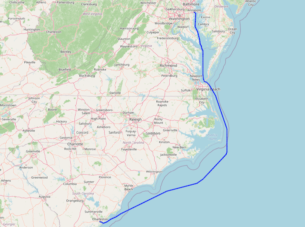
Sometimes, travel by sailboat is easy. Certainly this last trip from Charleston up to Annapolis was in that category. There was no bad weather, the winds were on the light side, frequently light enough that we didn’t really get a chance to sail, and gave a good bit of exercise to the Volvo. About the only disappointment (other than motoring 2/3 of the time!) was that the weather and daylight did not come together at a place where we could stop and catch some fish.
537 miles in just under 4 days.
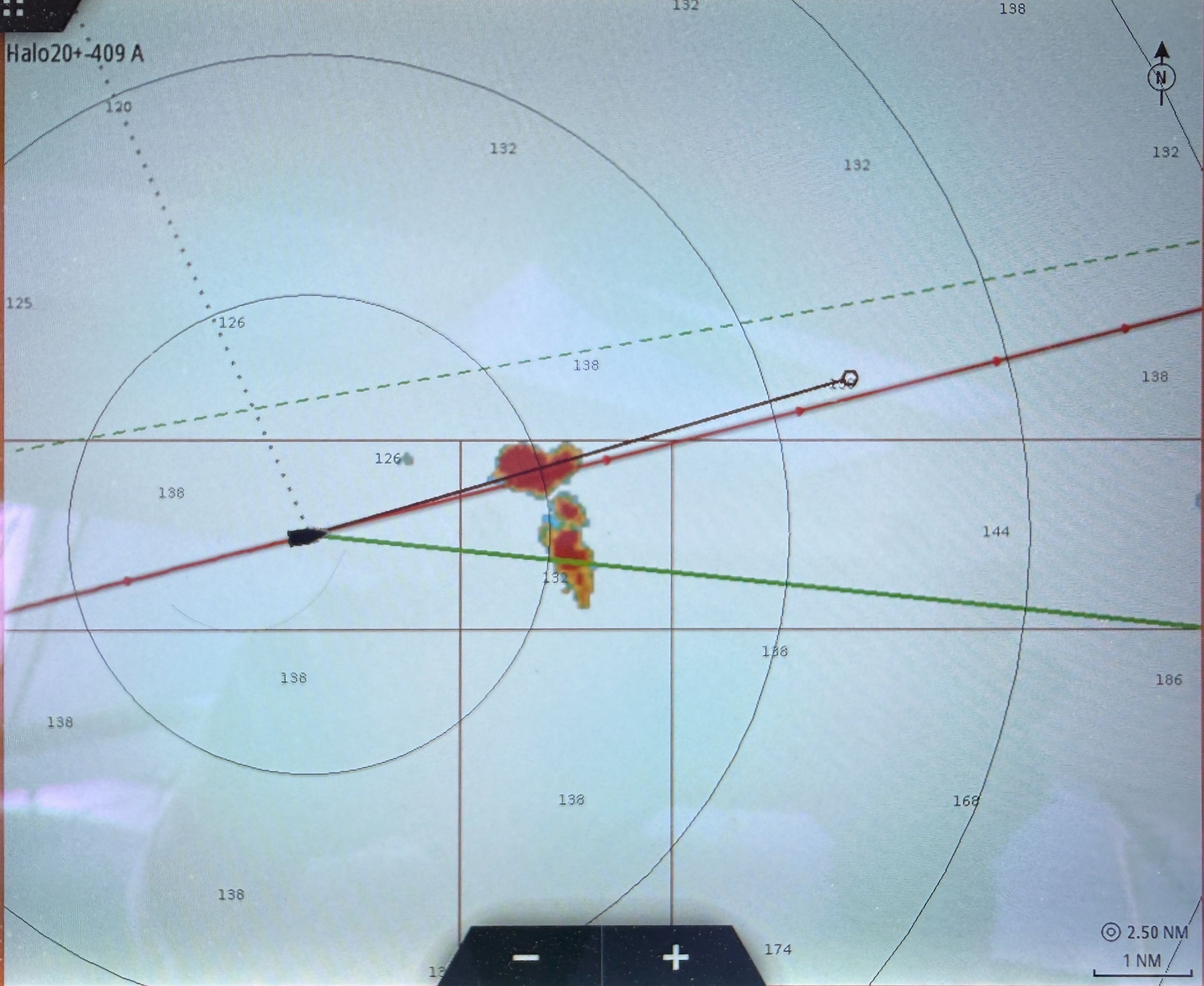
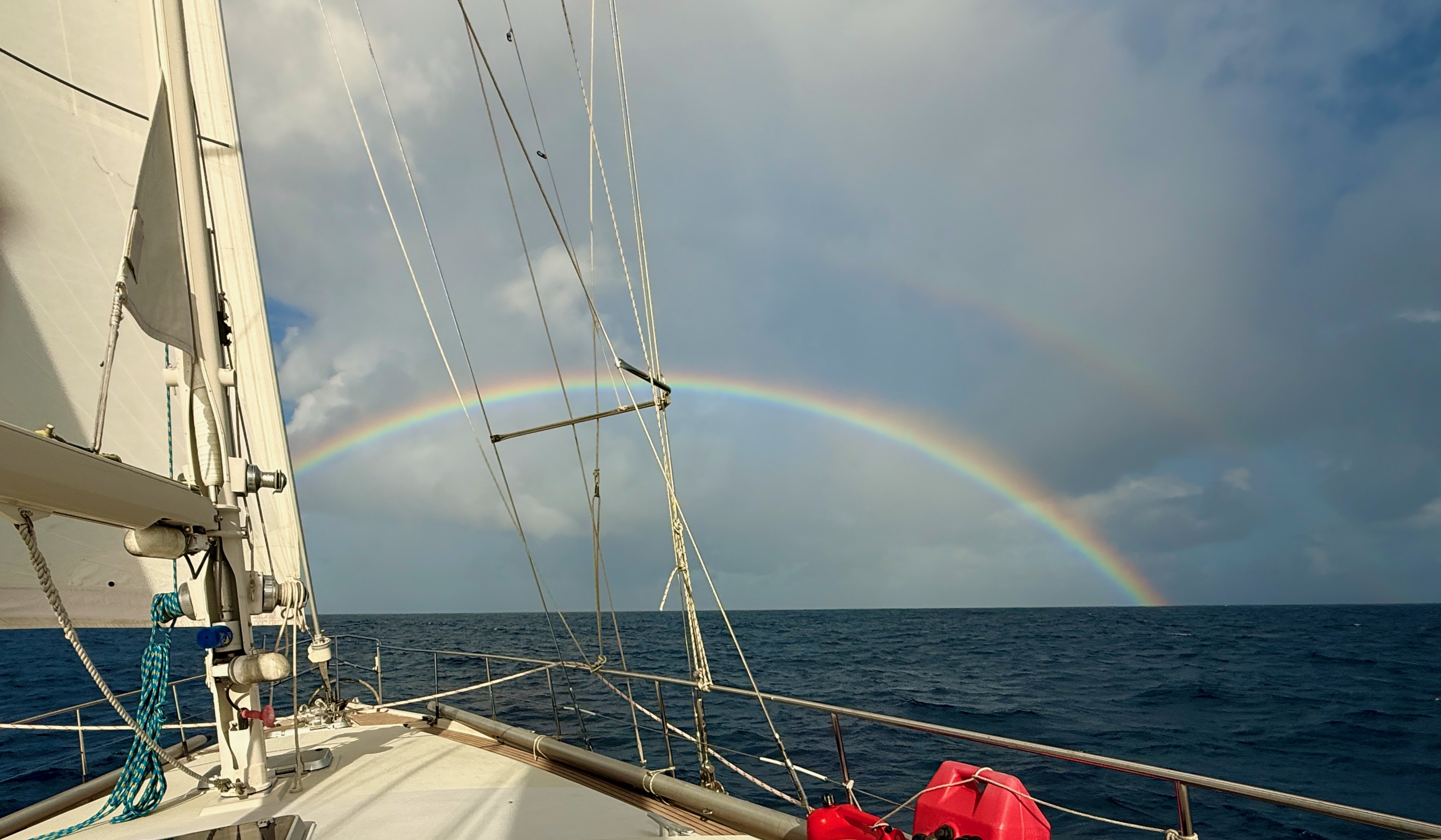
Chasing Rainbows
When we see this kind of image on the radar, we know that rain is in our future.
Sometime you do get a bit of a pretty picture as you approach the weather:
Unfortunately, that rumored pot of gold has remained elusive. When we catch up to the rainbow all we get is wet!
Play Time
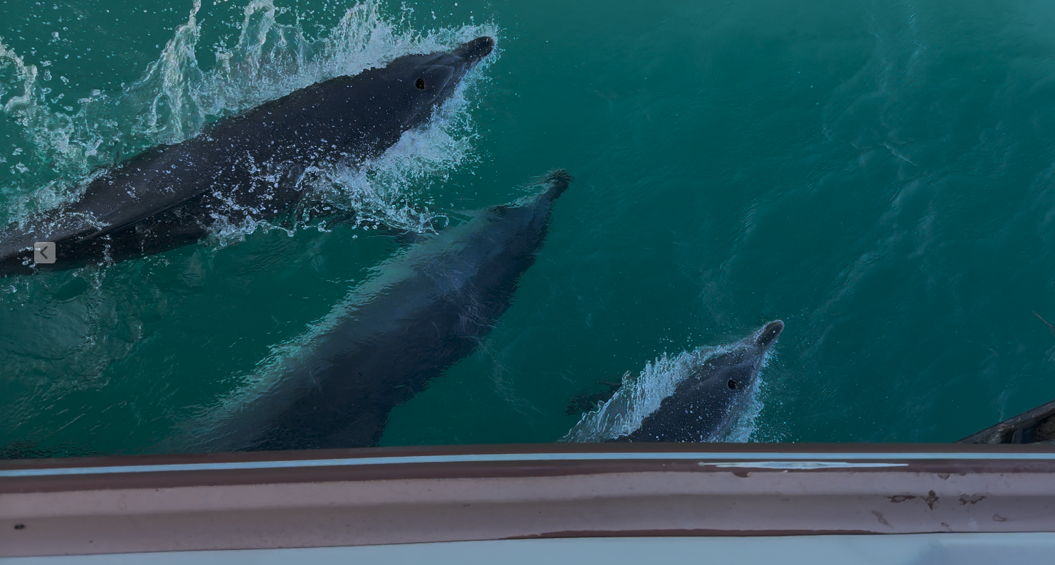
No trip up the coast would be complete without a visit from the local dolphins. This group of five stayed with us for over an hour. Just racing along as we sailed.
Annapolis Plans
We have a variety of things on our plate here. Some really exciting (not!) things like a dentist visit, some social events, some boat work. Right now we have picked up a mooring off the Naval Academy where we will spend the next week, then we have some running around to do and will be moving to a shoreside dock.
One of the things we will be doing here is to have the local Volvo shop give our engine a good going over. She is having her 30th birthday this year and is coming up on 11,000 hours and there are things that need doing I do not have the tools to do. She hasn’t given us a bit of trouble, and we hope to keep it that way for a long time.
Hopefully we will be done here before the end of June, and then we will head north toward New England.
I don’t often post about non-boat topics, but this seems to matter…
I confess I was being lazy. I KNEW how to calculate the answer, I even knew all the information I needed to do the calculation but it was late in the evening, I was tired and I chose to just skip the calculation. So I typed into the AI Box:
“How much does a gallon of mercury weigh, in pounds?”
It dutifully relied: “A gallon of mercury weighs 13.6 pounds”
I started to type that answer into the next step of what I was doing, and my brain slowly engaged, and a red flag popped up. “13.6 pounds”?? Hey, wait a minute. That’s not right. Not only is it wrong, it is really, really, really wrong. The correct answer is actually 113 pounds.
Now remember, this is the technology that is predicted to replace 40% of all entry level technical staff next year. Granted, that prediction is by somebody who will make billions for every dollar his AI company’s stock price rises, so he might have a billion reasons to inflate the capabilities of his product. But this is today targeting weapons in war. It is helping decide legal cases. It is being used to write scientific research papers. I find the incredible over-confidence in AI absolutely terrifying.
This is crazy. This technology might have potential, but it is–at least for now–seriously flawed. I would challenge any AI advocates to tell me why I should trust this technology to answer ANY question when it totally flubs such a simple question. It seems like it is especially dangerous asking it a question that you don’t already know the answer to. In which case what exactly can it be trusted to DO?
Just for my own edification, I decided to challenge the erroneous bot. “That answer is wrong.”
The bot replied: “Thank you for calling that to my attention. You are right, the correct answer is 113.”
The only thing more annoying than the original wrong answer is the obsequious need to thank me for correcting it. I do not value, not do I accept a machine’s apology or thanks. That is the very definition of “insincere”(1).
I continued, just to see where this would go. “How could you make such a mistake?”
“I am sorry, I forgot a step in the calculation.”
“Sorry”? “Forgot”???? Really???
How can we be turning over the world to computer programs who would fail a high school chemistry class?
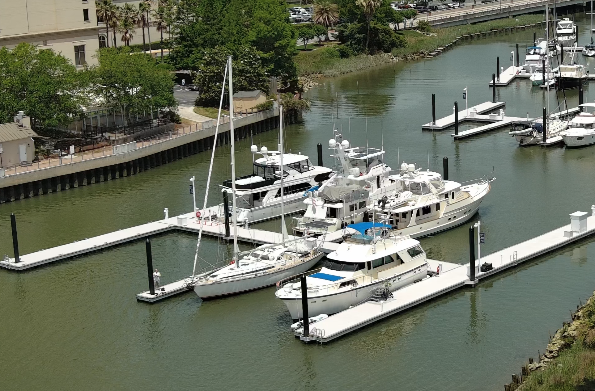
We have polished off our trip to Savannah. It is far enough inland up the Savannah river that it is a bit off our normal path. In the past we have bypassed it because access by water has been problematic. There are no nearby anchorages, and while there is a free public dock, it is strictly first-come-first served. Arriving in the late afternoon and finding no room would be a real hassle for us. Fortunately, last year a new marina opened, the IGY Savannah Harbor. Very reasonable in cost ($1.69/ft/day) neat and clean.
Harmonie at the IGY docks in Savannah
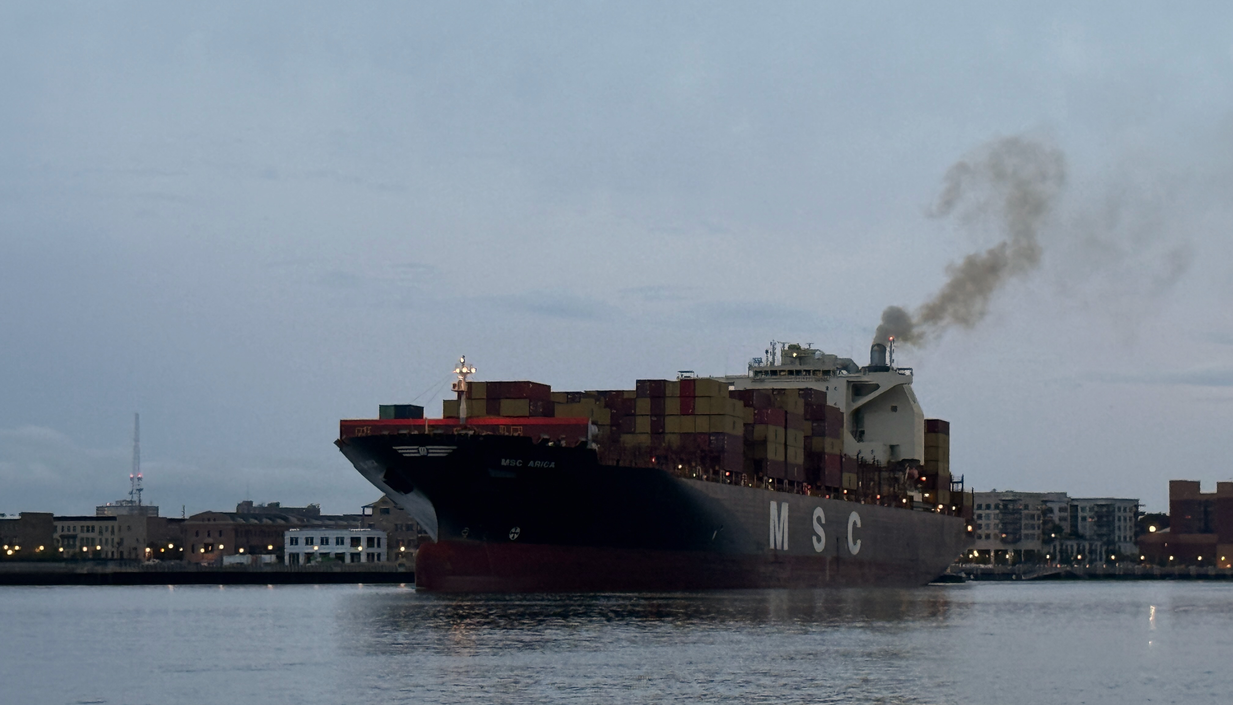
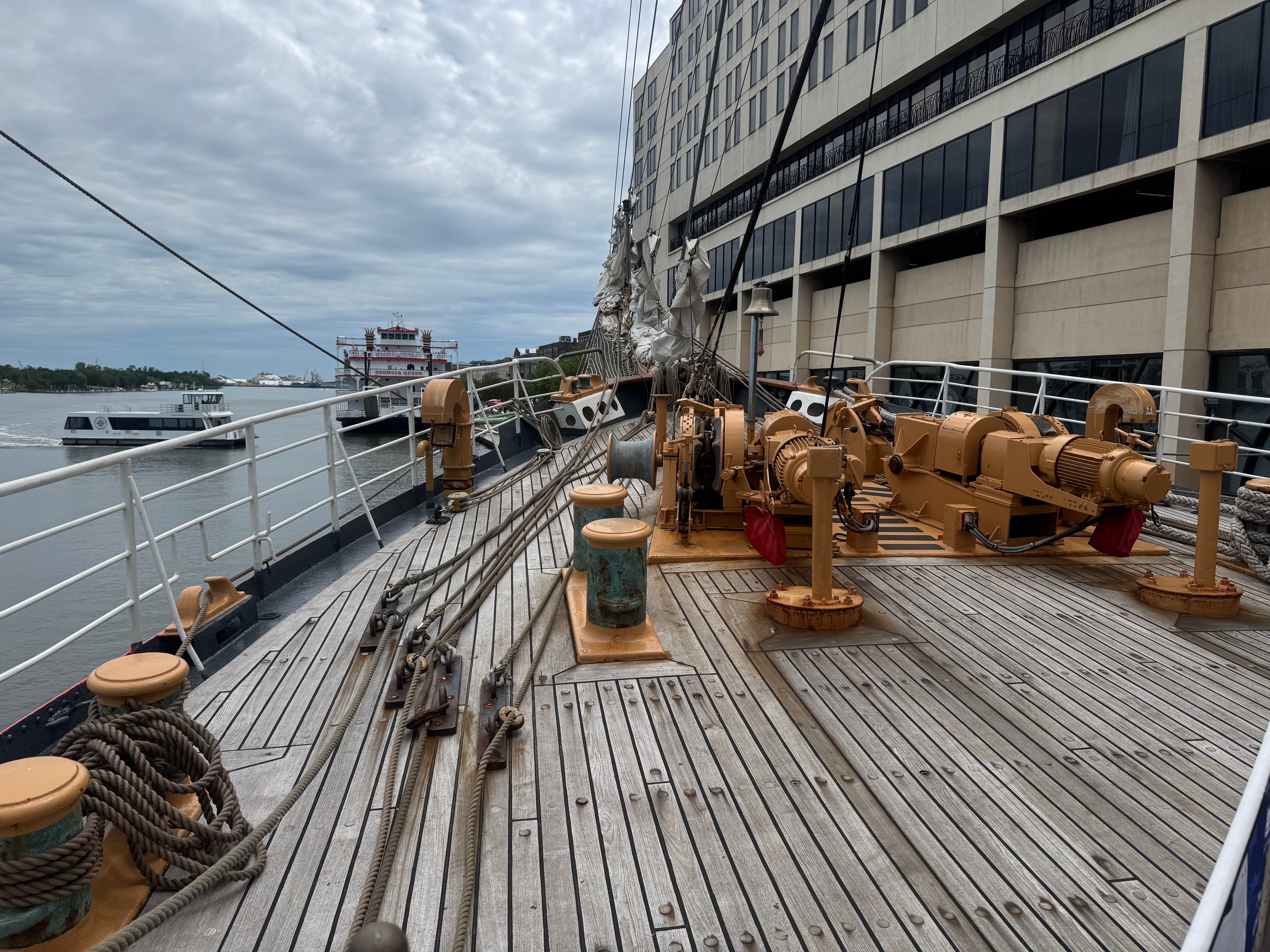
Savannah has been a major port in the region since its founding in 1733. Today the downtown waterfront of the city is bookended by the container port upriver, and the bulk material port on the downstream side. A lot of large ship traffic runs on the river.
The view from Harmonie‘s deck across the river to downtown Savannah.
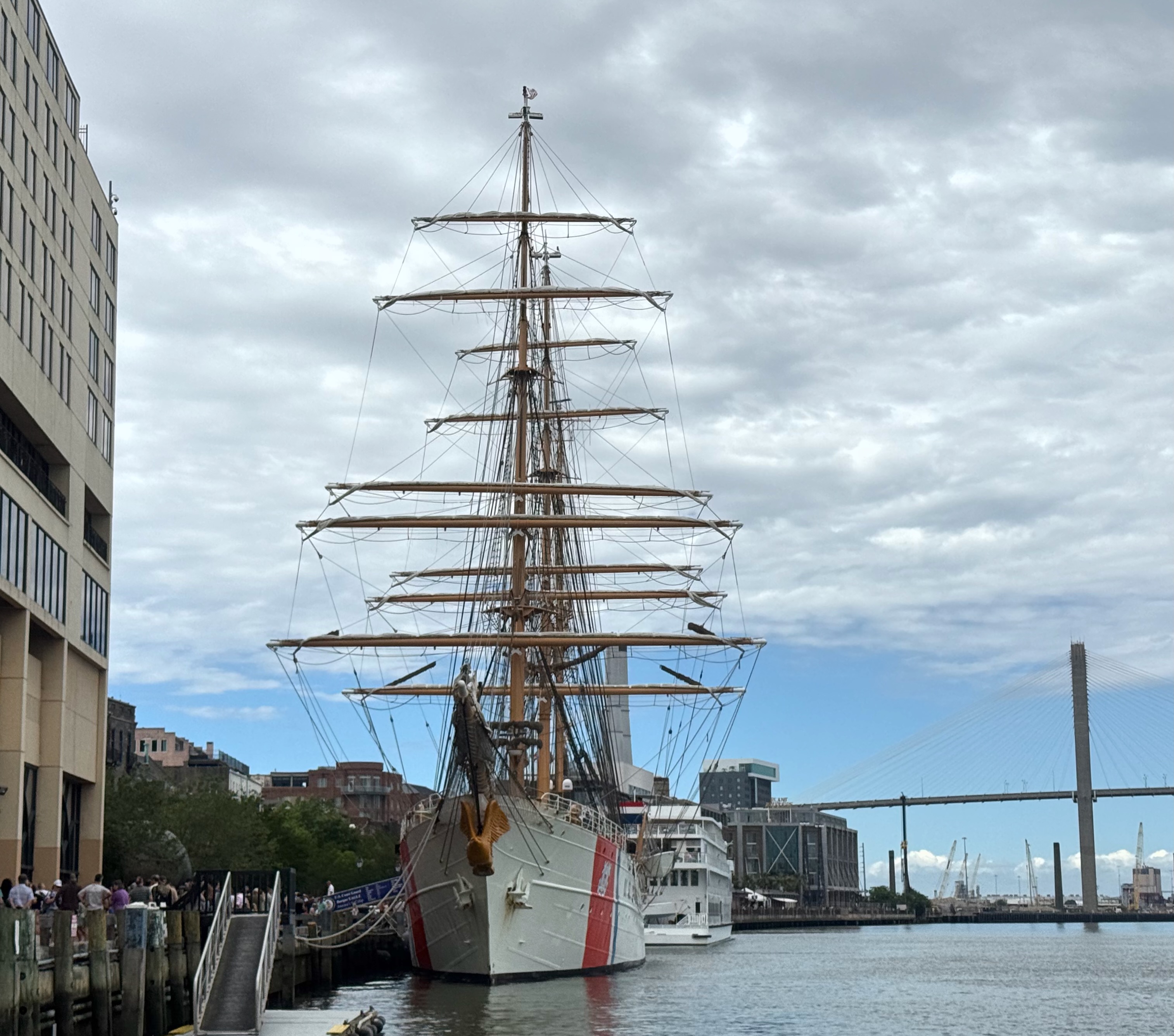
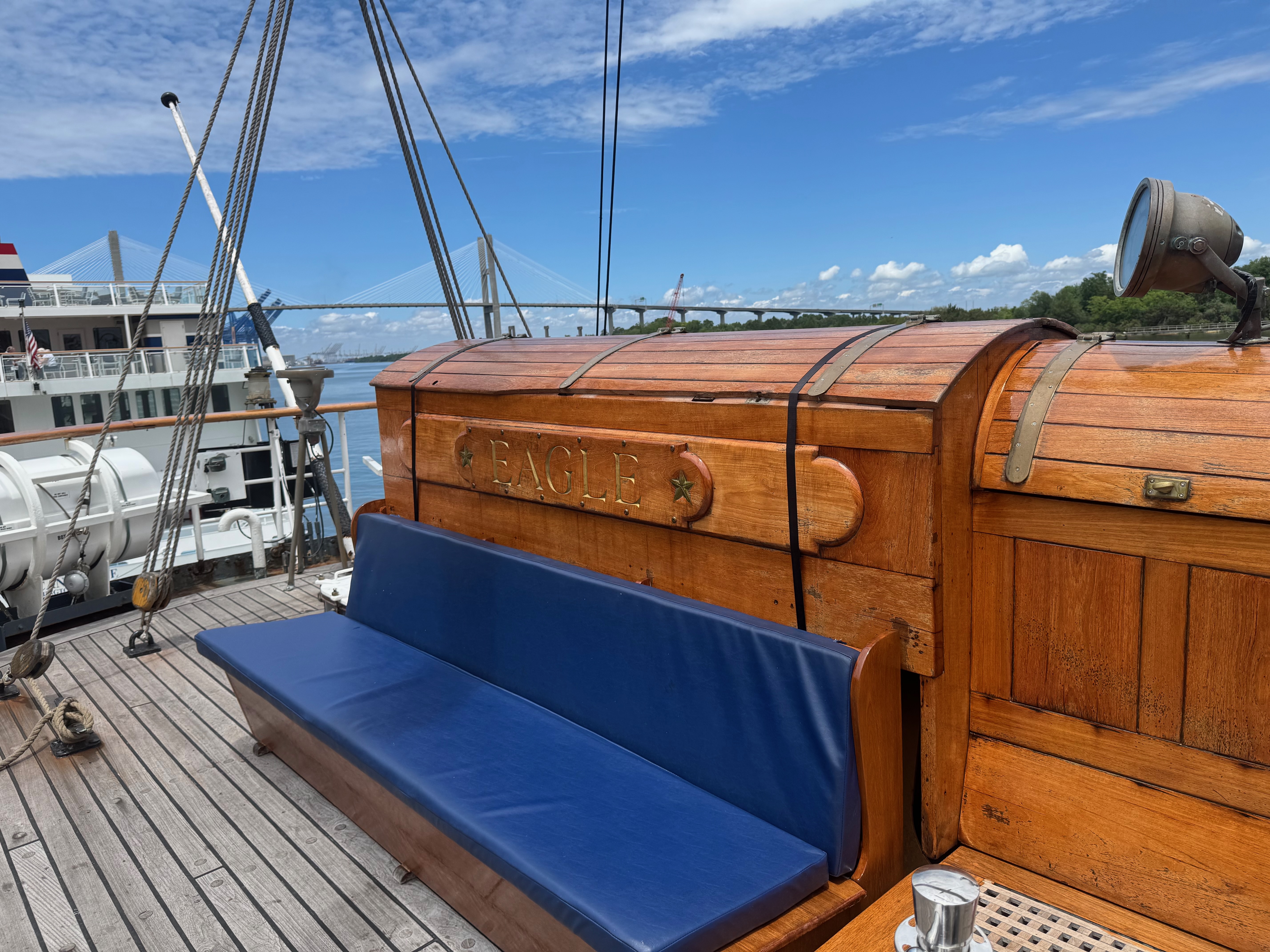
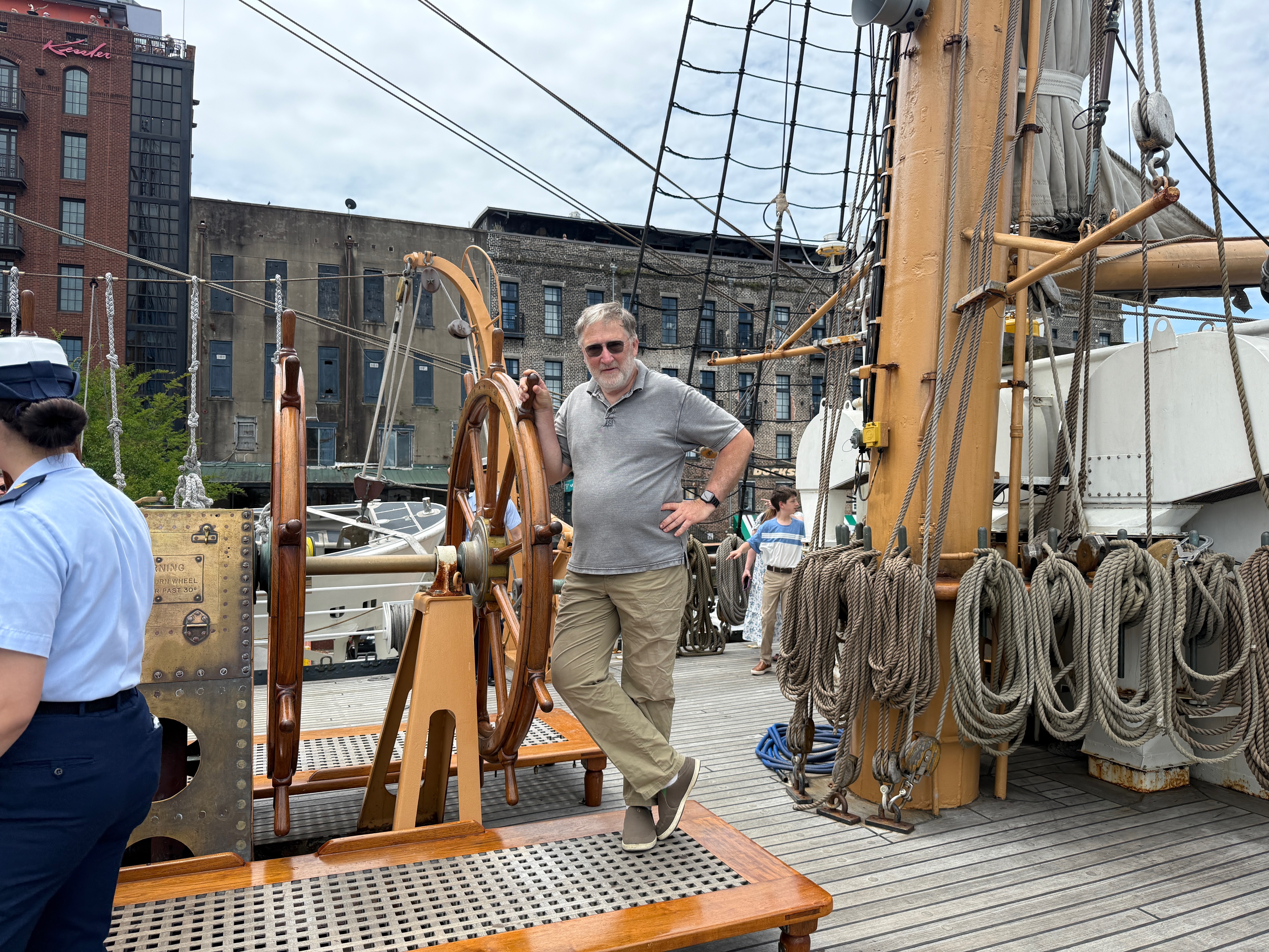
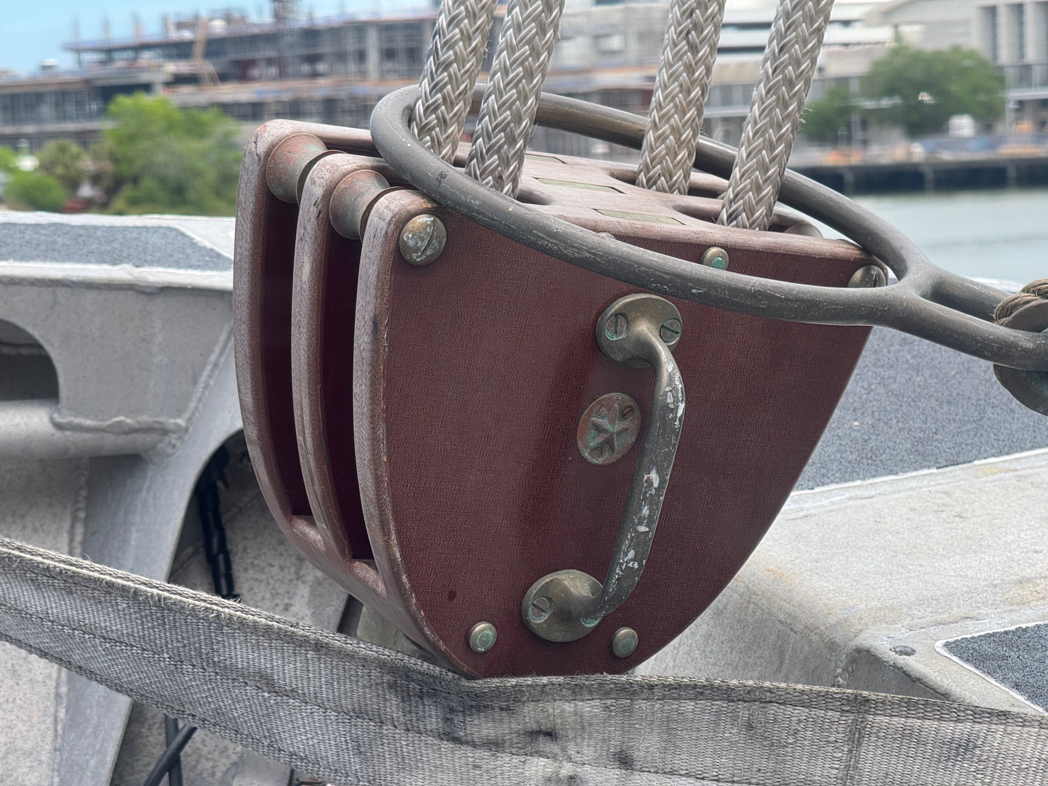
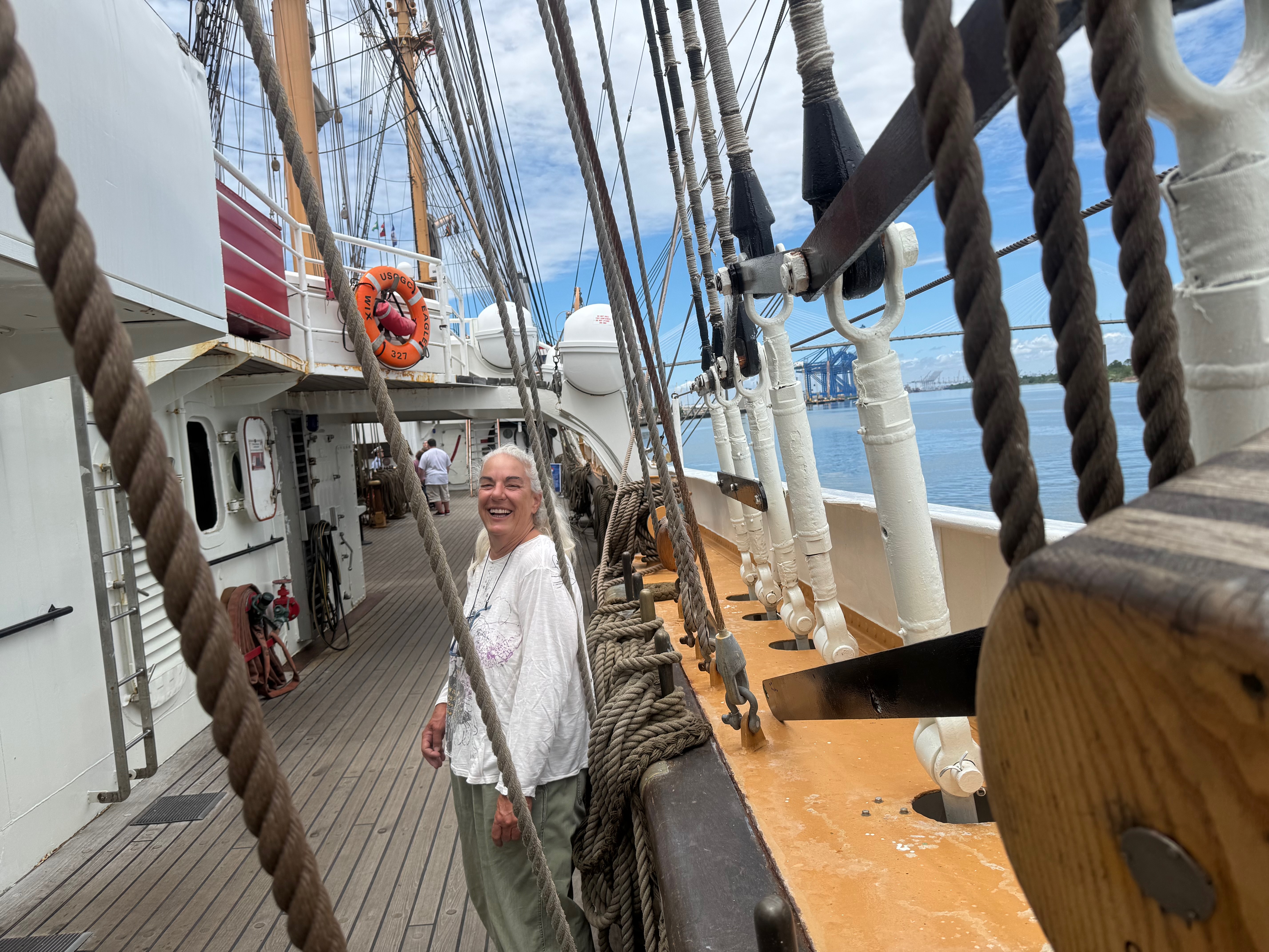
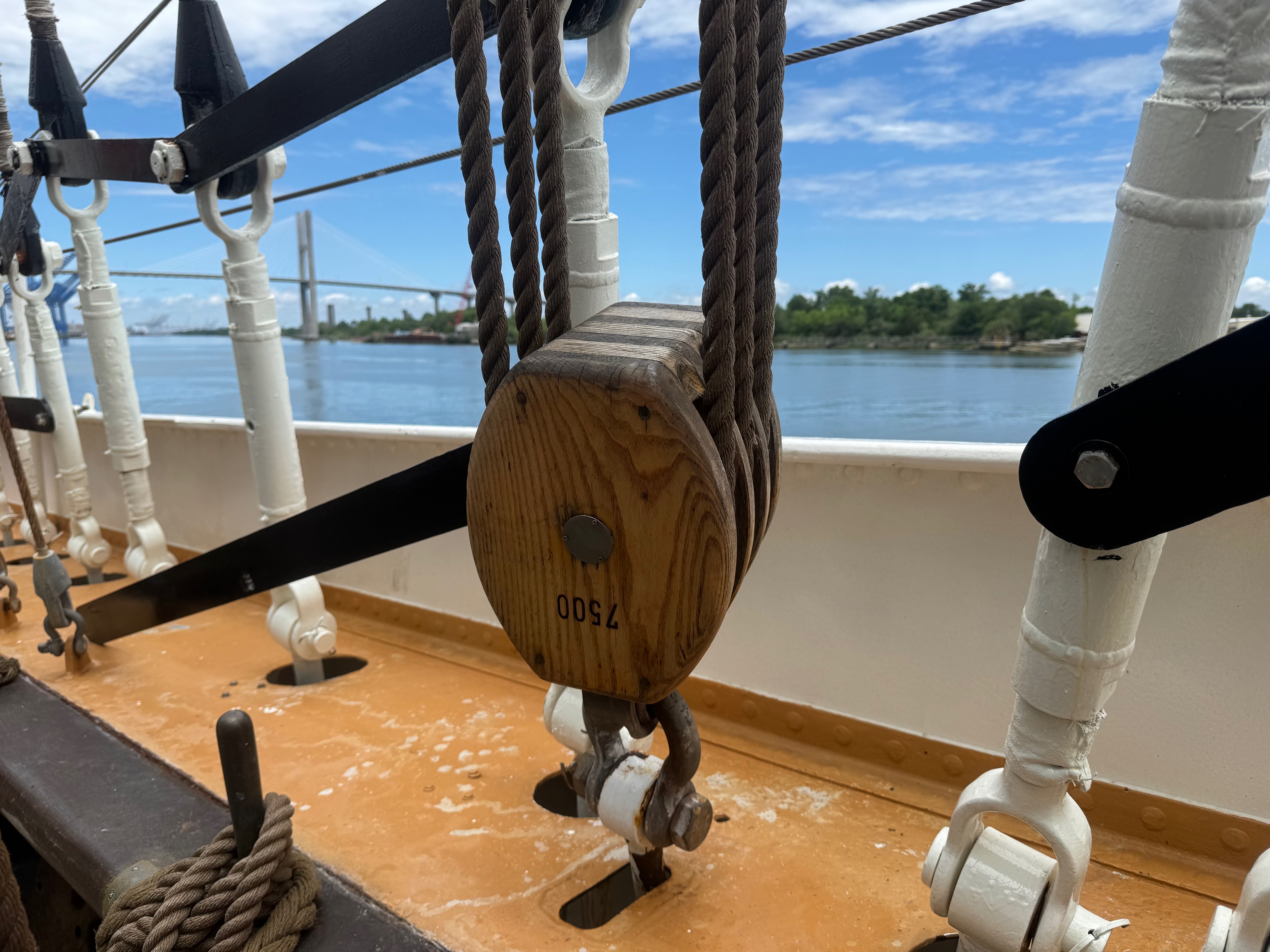
The Eagle
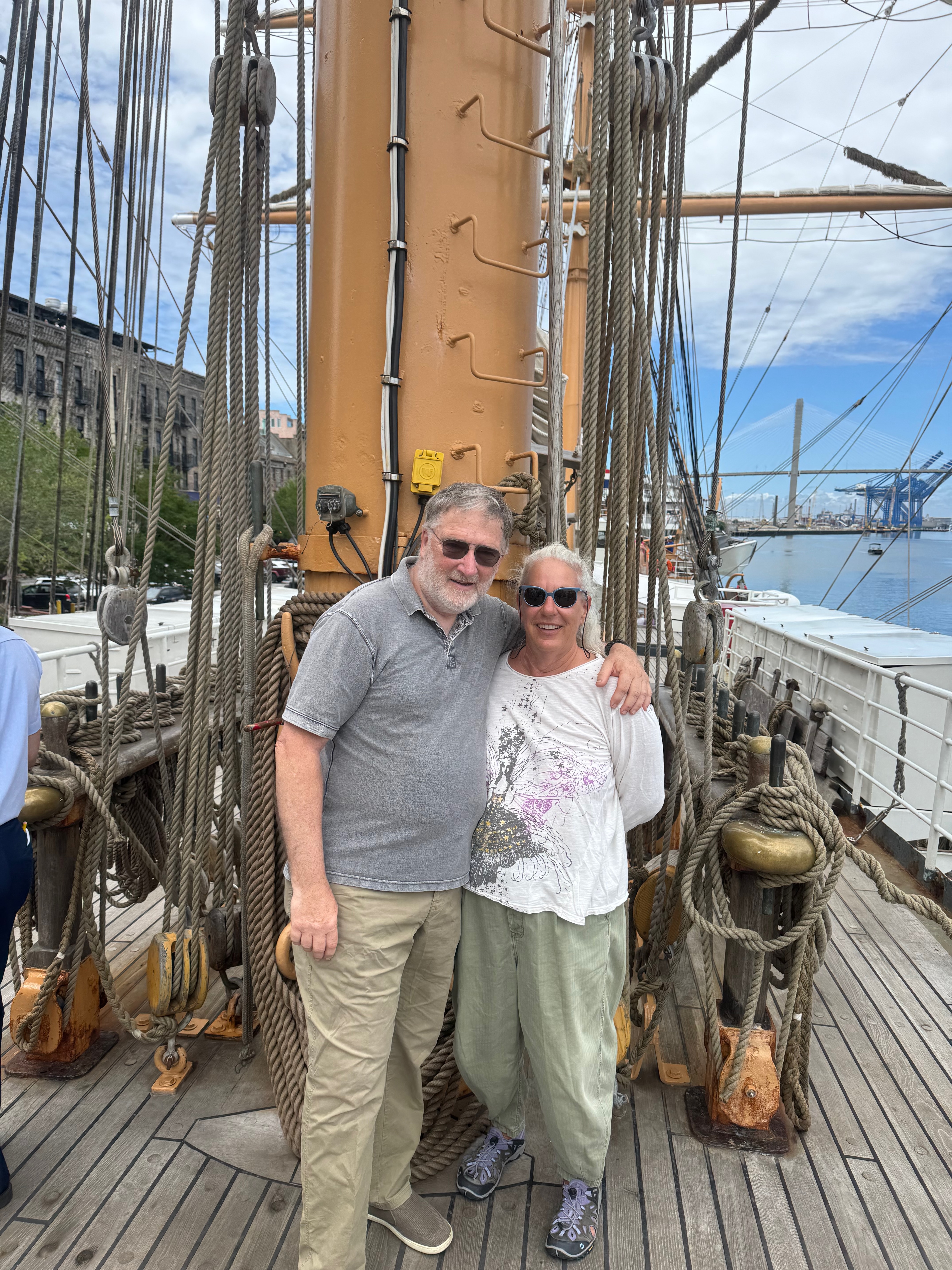
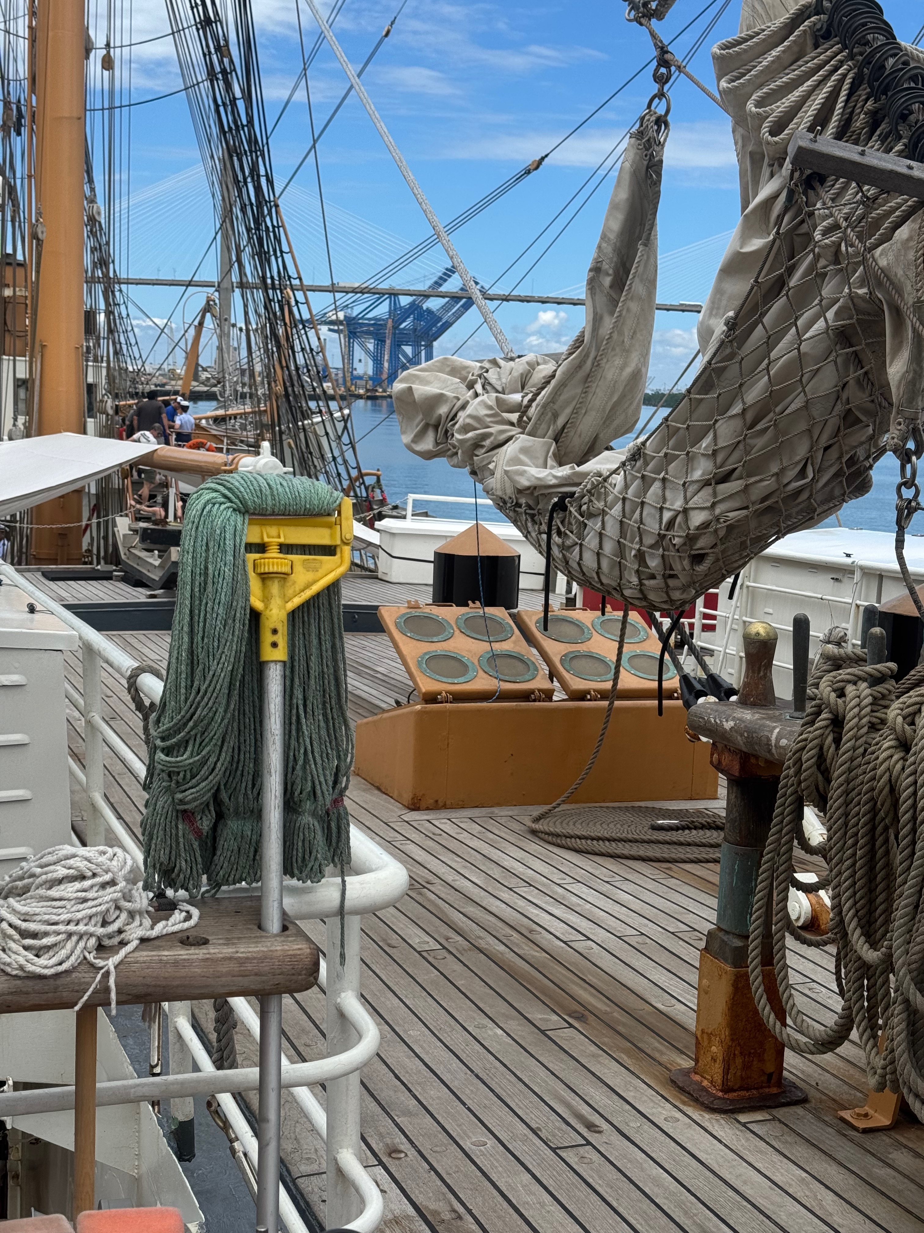
We had the good fortune to arrive while the US Coast Guard tall ship Eagle was in town and open for tours.
The dockside tours are pretty simple, you get to walk around the deck, with crewmembers available for questions. It is not everyday we get to explore a sailing vessel of this size and complexity.
And More About Boats
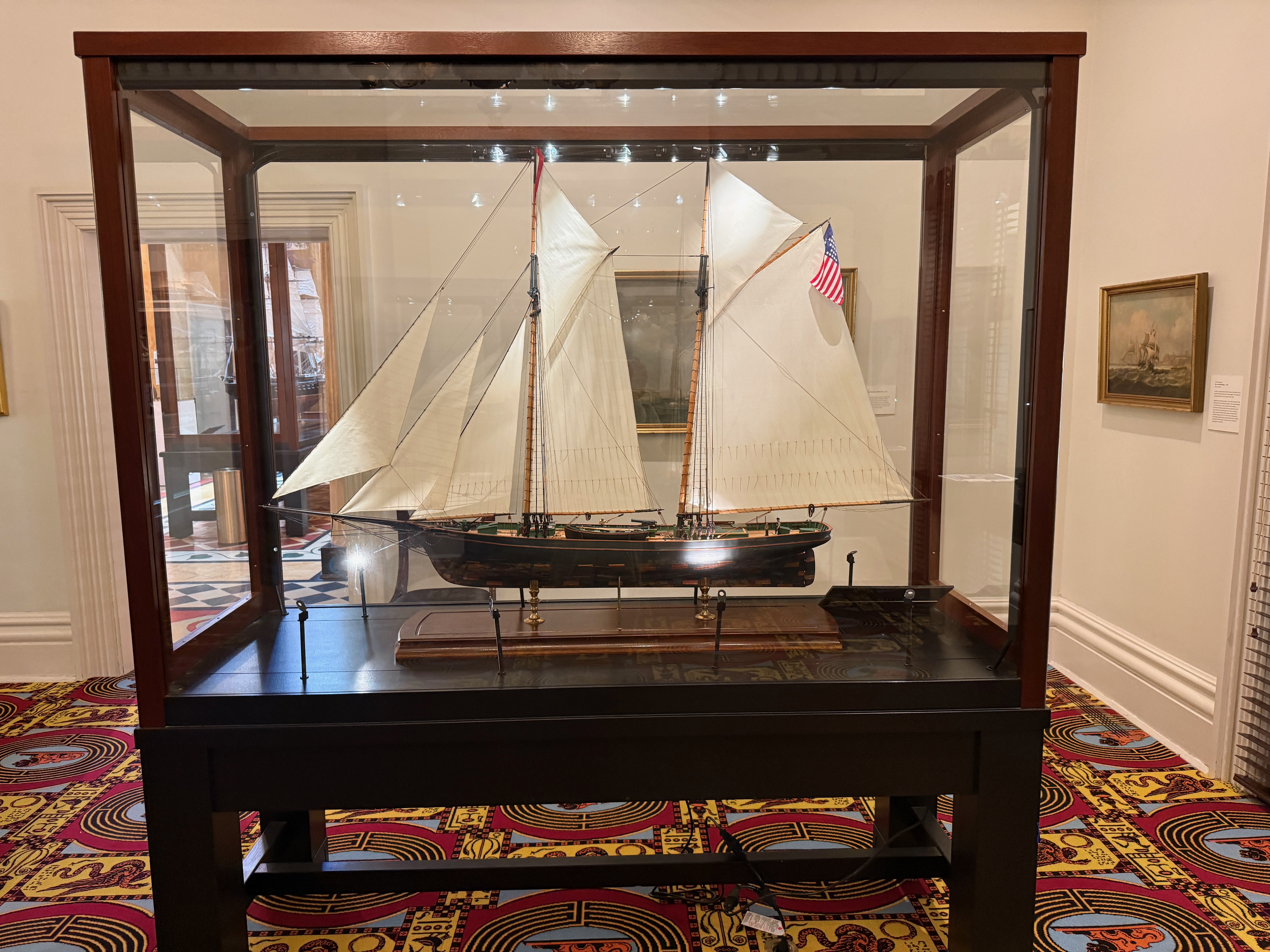
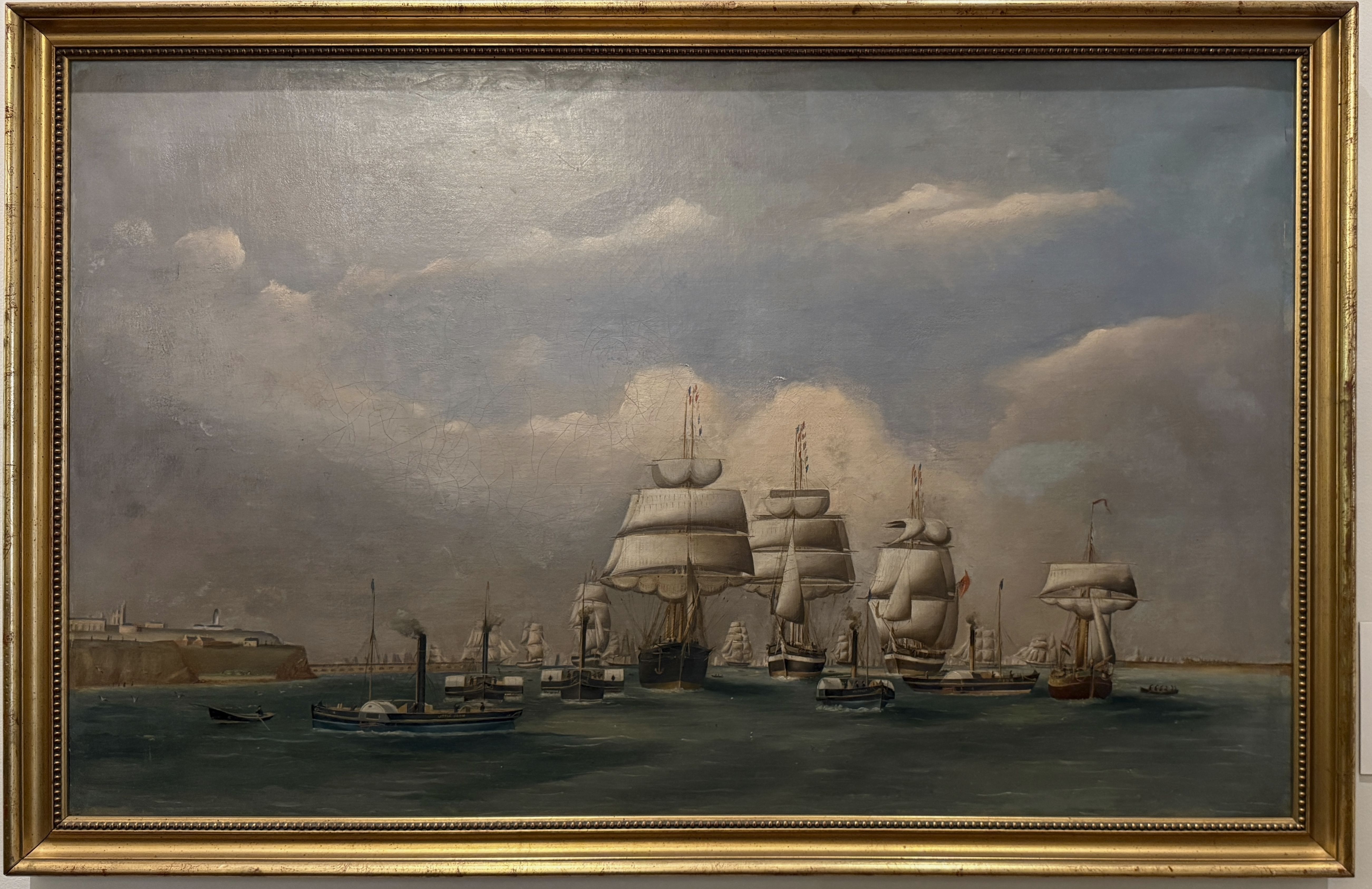
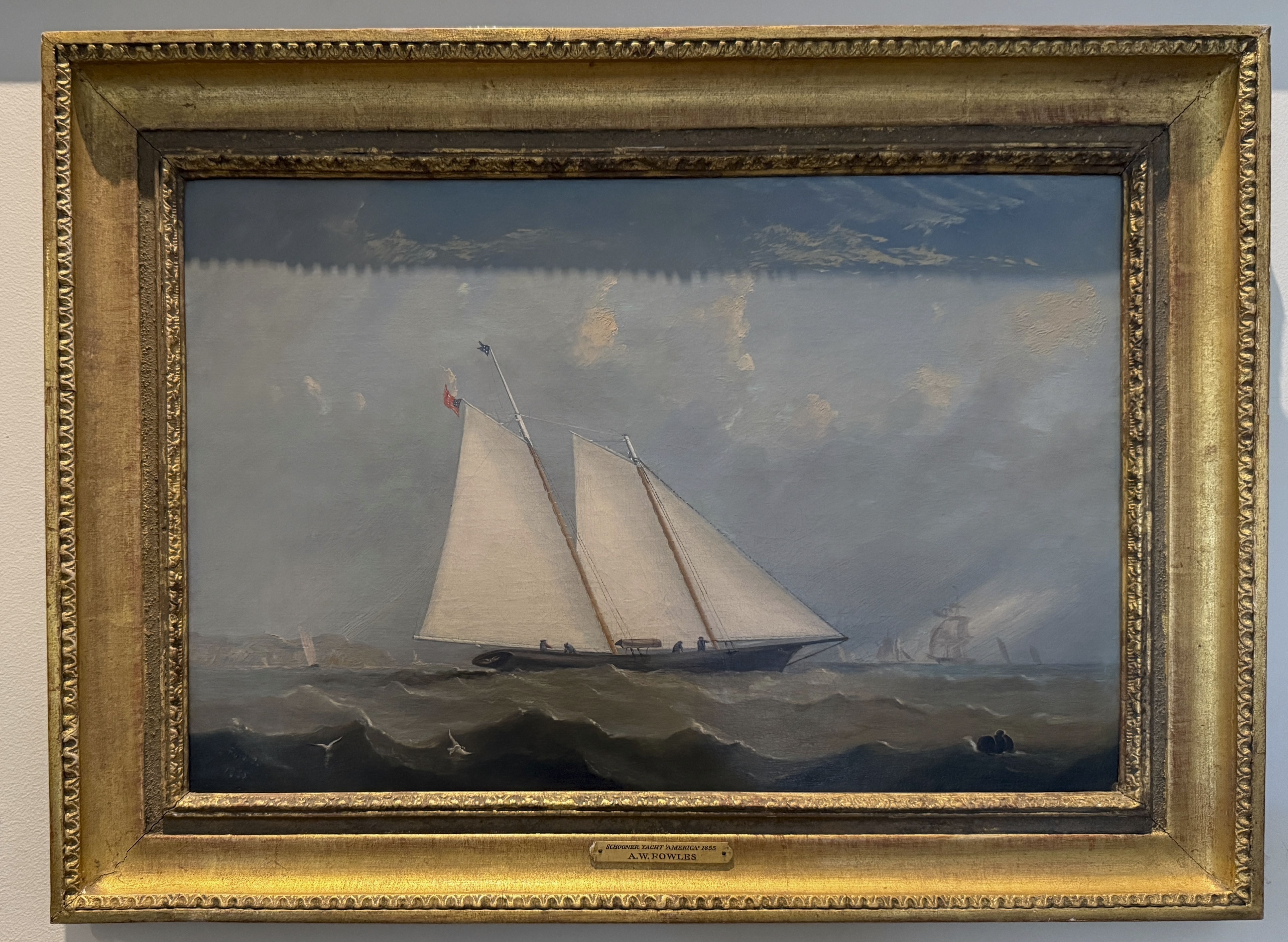
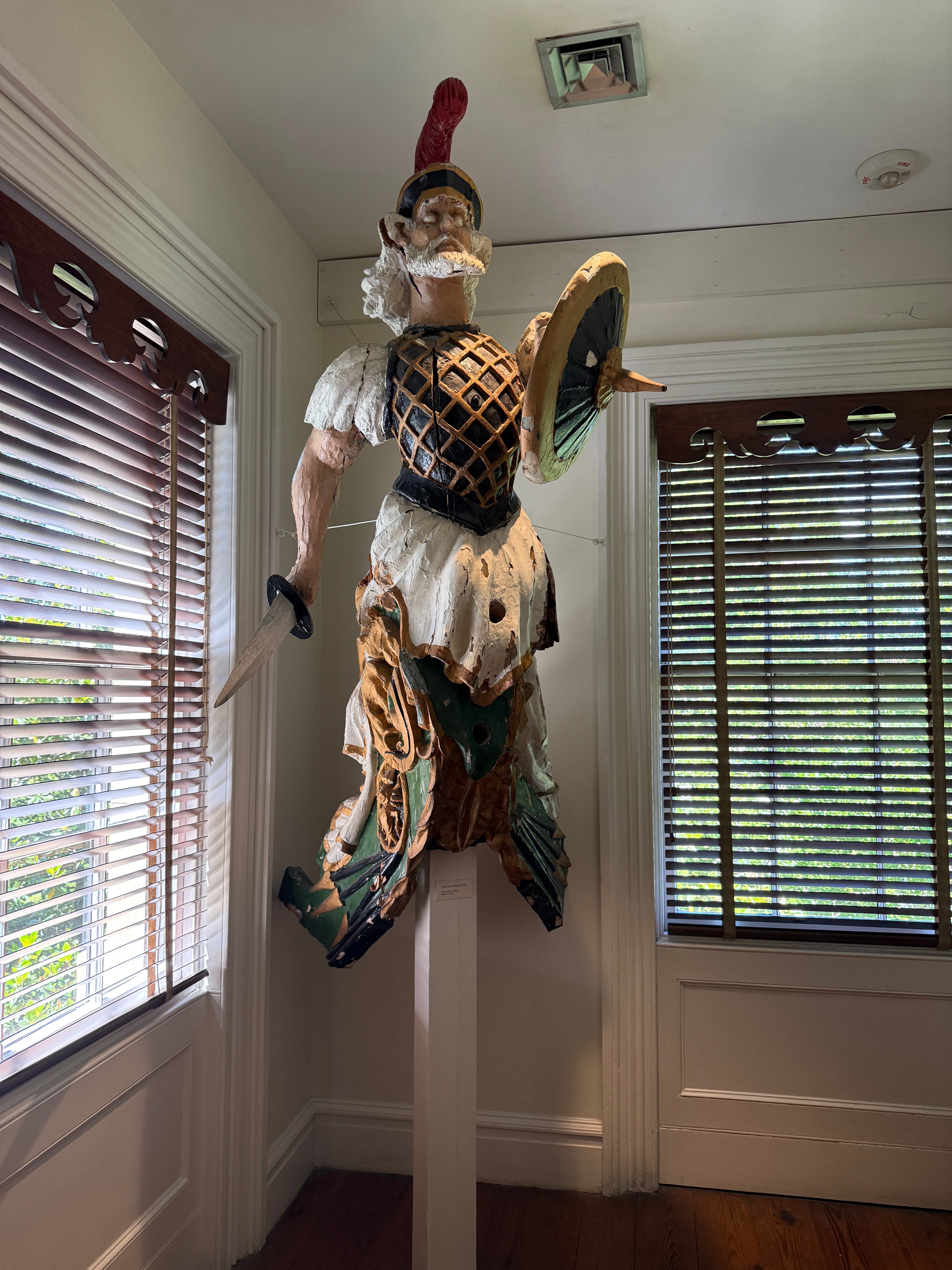
Located downtown is the Ships of the Sea Maritime Museum, it wasn’t on our itinerary, but the beautiful gardens around it drew us in. It was a surprisingly interesting way to spend an afternoon. The primary theme is centered on ships with a connection to Savannah. If you are an architecture nerd the building alone–with its long and varied history–is worth the stop. Overall, it is one of the better museums we have seen in a long time.
Overall Impressions
We weren’t as impressed with Savannah as we expected to be. That might be because we are on foot, and confined to the narrow strip of downtown along the river. It is a pretty town, with many parks and squares, and a lot of eating places. The restaurants we tried were varying levels of tourist quality. Nothing to write home about. If you are running on the ICW, you come right down the river here, and it is definitely worth the stop if you are looking for a small city urban experience. For us, it is not worth the trip up the river.
And next…
We arrived in Charleston Harbor and are anchored out off the historic Yorktown aircraft carrier museum. Our sail up here was a fitful one, with winds constantly changing from near calm to 14 knots. We must have raised and dropped sails at least a dozen times in the course of a day.
Tomorrow afternoon we will head over to the marina and get some of our shore logistics done. Weather permitting, we will be jumping from here to Annapolis starting on the 20th of May. Depending on our timing
After much too long tied to the dock, yesterday we dropped lines and left Brunswick, GA. We spent last night at anchor in St Simons Sound, and are now underway northbound for Savannah. The weather is mild, partly cloudy and calm. We expert to motor the whole way, ad arrive this evening.
This will be our first stop in Savannah. For a long time it was difficult to visit. There are no anchorages near town, and the only place to tie up was the city waterfront, which was convenient, and free, but it was all first-come-first served. Without a reservation, you always risked arriving, and not having a place to stay. Now there is a marina across the River with frequent ferry services to downtown.
We’ll spend a few days there, then jump to Charleston, then on to Annapolis.