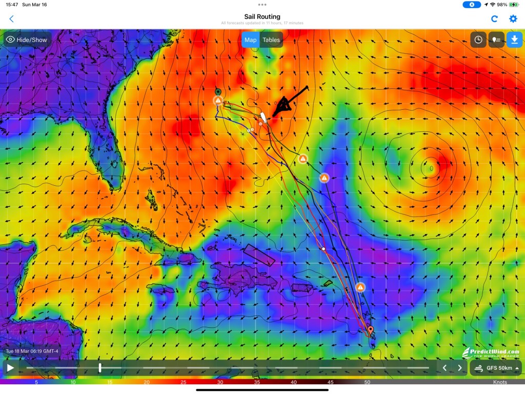
The route we are on is frequently called “Route-65” because you head east from the cost of the US and then when you get to 65W longitude, you turn south. On average, that puts you on a comfortable track. There are a couple of caveats to that.
It only Route-65 only works if you are far enough north to avoid the tradewinds in the first part of your voyage. If you try leaving from Florida, or the Bahamas there is no on ramp to Route-65. The other catch is that it assumes that weather will be “average”. One thing pretty much everybody knows is that weather is not often exactly average.
With modern weather forecasting tools we can pretty easily get details about what to expect for the next few days. Our forecasts are telling us that Tuesday morning we can expect a strong front to overtake us, which will pull the wind around to the Northwest as it goes by. At that point we will only be at Longitude 68W or so, about 180 miles east of the expected turn. But it makes little sense to blindly follow the “rule” when we will have a straight downwind shot toward our destination for several hundred miles.
The good news is that we will have winds from a favorable direction. The bad news is we will probably have two days of more wind and bigger waves than we might like, making for a “sporty” sail, albeit almost straight downwind.