We are waiting here in a delightfully protected little cove off of Harris Creek in Maryland for the passage of a weather front. Just north of the town of Avalon, if anybody is keeping track.
In the past few hours the wind has picked up out of the south, and the weather radar is showing heavy rain approaching, all as expected. Once the front passes, the wind will clock to the northwest, and we will be off for points south. All of the weather models predict a reasonably fast run down the coast. There is just one little issue…
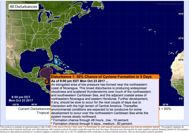
Yes, our buddies at the National Hurricane Center just could not leave well enough alone. After over a week without any activity at all, they posted this annoying update today. Interestingly, none of the models I see show any development of this system at all, but the guys who know better than I do say it is worth watching. The frustrating part is that it is likely to be a least few days before the status of this system clarifies for the forecasters.
So… here is our plan. We will head down the Chesapeake On Wednesday morning with the favorable winds. If there is still enough risk associated with “Disturbance #1” as we approach the ocean, we will pull into Norfolk, or Hampton Roads, and sit tight until we know more.
