After a hurricane passes over your boat there is one good result: Your boat is CLEAN. It basically gets a freshwater power wash for hours and hours. Yesterday we spent all day undoing all the things we did to prep the boat for the storm. This morning we pulled up our lines and anchors, and in less than an hour we took the boat from as clean as it has been in months to a filthy muddy mess as all the lines, chains and anchors did their best to move as much lake bottom to the topsides of Harmonie as possible.
A muddy mess!
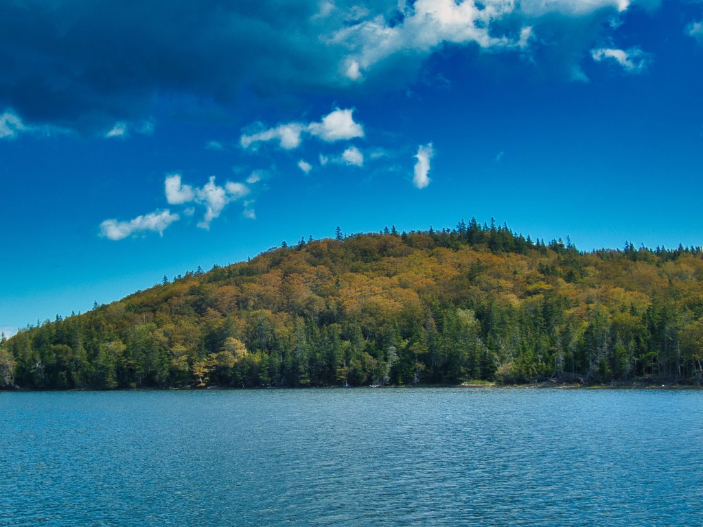
Under sunny, clear, and chilly sky we sailed south on Bras d’Or Lake. On the shores of the lake we see the first hints of fall color showing in the maple trees. That can only mean one thing: It is time to turn further south before winter arrives.
Fall color starting on the hills.
We are anchored at the southern end of the lake, at the town of St Peters. We tried to do a grocery run today, but the storm still had power out in much of the town so the grocery store was closed. Tomorrow, it is supposed to be open for business again so we can stock up for our coming passage south.
Our weather forecasts suggest that we wait a day here before taking passage through the canal back into the Atlantic. Our plan is to reverse the route we took to get up here two months ago: Leaving from Nova Scotia, straight down the coast to the Delaware River, through the Delaware Chesapeake Canal, then down to Annapolis. A total trip time of about seven days.
Other than the muddy water in the harbour and leaves scattered on the ground, there is little evidence of anything having happened. It is a cool, breezy, sunny morning. Harmonie is right where we left her. All is good!
We were talking earlier today about the “good old days” of sailing. Back when we mgiht have heard that there was a hurricane that had hit the Bahamas last week, and this morning it was a bit cloudy and breezy, then… SURPRISE! Maybe they weren’t so “good” after all! A week of preperation was a good thing.
Right now here in the early afternoon we are watching the winds build and the first spits of rain fall. Its very hard to figure out exactly what we should expect, since the terrain here has such a big impact on the wind strength and direction, but so far it looks like the storm will pass to the west of us. That means stronger winds, but from the south which is what we most prepared for, and a bit less rain than the other side of the storm.
Hopefully by this time tomorrow we’ll be setting Harmonie up to be sailing again.
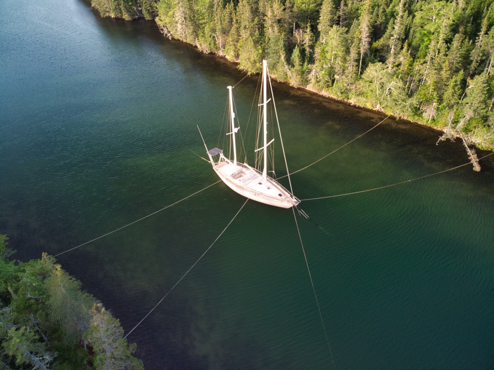
We are almost as ready as we will ever be. We are about 36 hours from the first touches of Dorian.Right now it is dead calm, quiet, and clear. Harmonie is settled in to a narrow shallow cut off the main lake. She has our 110lb main anchor off the bow, our 88lb spare anchor set off the stern, both set hard and deep into muddy clay. She is tied to each shore by a multiple of lines. As much of her gear as possible has been stripped off to reduce windage. She is as safe as we know how to make her. For the duration of the storm we will be staying at a friend’s house high on the hill overlooking the anchorage so we can keep track of our girl. We will be safe, and we expect Harmonie to be as well.
Located here far in from the ocean we have few hazards to deal with. The will be no large waves, no significant storm surge. The steady winds will be below hurricane strength, although we might see significantly stronger gusts. The expected heavy rains really aren’t a concern for us. This far north, the storm will be moving very fast, so will be rather short in duration.
Wireless internet connectivity here is very marginal, and the chances of the local neighborhood keeping power are probably slim. We’ll do our best to post our status right after the weather passes, but it might not be possible.
Now, a word about the people here in Atlantic Canada. Nowhere we have ever been–anywhere–has friendlier people. It is literally true if you ask them directions to the store they will hand you the keys to their car. Ask to borrow a shovel, they’ll dig you a hole. If you ever doubt the basic goodness of human nature, spend some time here.
One of the nice thing about having a network of people is you get help from unexpected places. After our post about our hurricane plans we got an email from one of our Amel correspondents who has a house here on Bras d’Or lake with a perfect “Hurricane Hole” in the tiny harbor behind his property. Although he is on his boat in the Med, he made the effort to offer his advice and suggestions.
So, instead of running off toward Quebec, we’re going to tie down here. Thanks James, there’s a bottle of rum in it for you when our boat’s paths cross! It’s less than 25 miles from our current location, so we should be there and starting the process of securing Harmonie tomorrow afternoon.
Right now, we are directly under the forecast track of the storm for late Saturday. It will certainly be significantly smaller, weaker system than it has been, but still potentially dangerous. Since it is travelling so close to the coastline, very small changes in its track in the next day or so will make a huge difference in its strength and exact location this far out. Here, quite far from the open ocean we have no real storm surge to worry about, and no serious waves. We’ll take all due precautions, but are comfortable with our plan.
The official NOAA Hurricane Center Forecast for Dorian out five days has the storm still at hurricane strength AND located right on top of where we are now. There is only one thing to do:
Run Away!
In this case running away means heading as far to the west as we can go on the strength of several bits of logic. Hurricanes almost never turn west this far north. Even if it did, to get to us it would have to travel a significant distance over land before reaching us, and drop a lot of its punch.
So today is prep, and tomorrow we head out of Bras d’Or lakes, around the northern end of Nova Scotia, and into the Gulf of St Lawrence where we will run as far up the St Lawrence River as seems prudent based on the weather forecast.
The good news is that there are many places to duck into to hide, and if the storm track changes we have a reasonable amount of flexibility. If the strom arrives sooner than forecast, the initial winds will help drive us away, so over all, we’re going to be taking this bet as the best option.
Some of you might have heard that a moderate solar storm was forecast for this past weekend, which brings the Northern Lights further south than they are normally seen. Being in a place pretty far north, and quite dark, we figured this was a great opportunity for us warm weather creatures to observe this phenomenon.
So we pack up our dinghy with the photography gear, warm clothes, and a thermos of hot tea, and headed off to a small island so we could get a better view of the northern horizon. We arrived at twilight, with the cresent moon setting in the west.
We tried to avoid disturbing the harbor seals and cormorants surrounding the island, and set up to wait for the excitement.
Since the best viewing times for an aurora are around midnight, we had some time to kill. So I warmed up by getting some pictures of the Milky Way high and bright in the southern sky.
I did a fair amount of research on the technical issues with this kind of photography, but hadn’t every really done it. I was surprised how easy it was, and how beautiful the images came out. I quickly realized that these images are pretty, but they would be the same everywhere, so the key to making them more interesting is adding an interesting foreground.
That’s a little bit better. It gives you a little sense of place with the image. But I am pretty sure I can find something prettier for the foreground.
Oh, yes… back to the aurora. It did make an appearance, unfortunately it really wasn’t visible to the naked eye, but the camera did pick up the purple and green lights in the northern sky.
This first image is about what we saw with eyeballs Version 1.0
The Nikon was able to pick out the faint glowing curtains of the aurora.
The bright dotted lines you see are airplanes moving while the shutter is open for the long exposure. I suspect that without the lights of town to the north the display would have been more impressive to the unaided eye.
We are keeping an eye on the movements of Dorian. Both out of concern for people and places we know and love in its path, and to remember that after it finishes leaving a trail of tears behind it in the Bahamas and the Southeastern USA, it heads north as a significantly reduced, but still important storm. We have several options for places to hide if we need to.
As the “Big City” (Pop. 793) on Bras d’Or Lake, Baddeck is where it all happens. Just to put things in perspective, we are about 4 hours by car from Halifax. Baddeck had been on our list of places to see up here because it came strongly recommended by everybody we know who has been here.
Baddeck is a delightful little town on the “Cabot Trail” the popular driving tour of the area. Even more than the other parts of Nova Scotia (Latin for New Scotland) Cape Breton Island is connected with the “old country.” Coming in to the harbor, you are likely to hear the sounds of a bagpipe drifting over town. Many signs around town have Gaelic names on them. (With the possible exception of Welsh, I think Gaelic uses more letters to make fewer sounds than any other language!)
When we arrived up here we were ahead of the remnants of tropical storm Erin. The local forecast was for heavy rains and winds of 35 knots. Nothing terribly serious but not something to be ignored either. So we found a snug little harbor, and for the first time in a long time set a second anchor. Not because we wanted more holding power, but because swing room was restricted. Fortunately for us, and the locals, the forecast turned out to be a bust. I doubt we ever saw more than 15 knots.
The tender loaded with the spare anchor.
Recovering the second anchor, turned out to be a bit of a challenge. We ended up drifting up against the mud bank and needed the dinghy (again) to push us off. No harm, no foul! We had quite the muddy mess on deck when we finished.
Braddeck has one big claim to fame, its most famous resident was Alexander Graham Bell. After making his fortune in the telephone business, he settled here and lived as a renaissance inventor dabbling in the new field of powered flight, and high speed boats. He even speculated on the use of hydrofoils for sailboats, a development that took 100 years to come to production.
The Bell estate at the enterence to Baddeck Bay. Still owned by the Bell Family.
Like everywhere around Bras d’Or Lakes natural beauty is everywhere. The landscape is different than southern Nova Scotia. Instead of exposed rock, and rugged cliffs, this is rolling hills of bright red soil. A much wider variety of trees grow in the forest.
A scene typical of the shoreline of the Bras d’Or LakeHow dark is it here at night? Dark enough to see about a bizzilion stars…
In addition to the beauty of nature, they also have some very pretty boats up here.
Built in 1935, and rescued after 50 years in a garage by the original owner’s grandson, Rosie is a work of love and art.Harmonie gets photobombed by the local tourist schooer, the Amoeba
We’ll be in this area for a few more days, and then maybe move back out into the ocean and stop at Sydney. From there if the weather allows we’ll head to Sable Island again, or if not, begin our passage south. Right now we are watching the long range forecasts for Dorian’s track. Out seven days or so (about two forevers in weather forecasting) he is destined to be in our neighborhood.
Our sail from Sable Island back to the mainland was a delight. Overnight we saw water with as bright a phosphorescent glow as we have ever seen. Doubly fun when dolphin swim by looking like glowing green comets in the water.
We arrived at the south east corner of Cape Breton Island, at the village of St Peters where we entered Bras d’Or Lake (pronoiunced “ba-door”) with an experience new to us: Taking Harmonie through a canal lock.
The lock gates in the St Peters Canal.
The swing bridge at the lake end of the canal.
The canal was built 150 years ago, and connected the lake with the ocean. Since the tides in the lake and ocean here are out of sequence by up to 4 feet, the lock was needed.
Once in the lake, we put in at the St Peters Marina for easy access to the grocery store and to top off the fuel tanks. A very low key and quiet place.
Bras d’Or Lake is huge estuary that drains most of Cape Breton Island. It has a small natural opening to ocean at the north end, and the St Peter’s Canal to the south. It is about a 50/50 mix of salt and fresh water and hosts a unique eco system. Where else do flounder, cod, and trout live together?
Sailing on a lake is different than in the ocean. The wind is more fickle, as it twists and turns around the hills and valleys, and the water is very calm, lacking any of the ocean swell we are used to.
We have found a small harbour fittingly named “Little Harbour” where we anchored to wait out an approaching nor’easter that is threatening tomorrow. Once the weather calms again, we’ll be making our way further up the lake to the town of Baddeck, the cultural capital of Gaelic speaking Cape Briton.
As our email inboxes fill with the manic notices of end-of-summer sales from numerous sellers of VIS (Very Important Stuff) we realize that our time this far north is getting short. Our plan is to head out in to the ocean at the north end of Bras d’Or Lake and begin our southern migration. If the stars align perfectly we might get another stop out at Sable Island. From there we expect a stop at Newport, RI, and then on down to Annapolis by early October.
Sable Island is a 26 mile long, crescent shaped, sand pile over 100 miles from the coast of Nova Scotia. It is so remote that it is visited by only 6 to 8 private boats a year. Most people who do visit come by chartered airplane, or “eco-tour” boats and spend no more than a few hours on the island.
How most people get to Sable Island
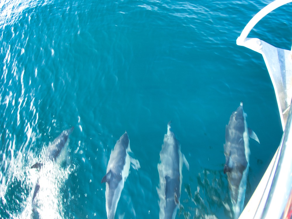
As we approached the island, we were escorted by a pod of common dolphin. We could see them in the distance, but as soon as they see the boat, what ever business they are up to is discarded for play time! They made a beeline to the boat, and spent 15 minutes riding the bow wave.
“Look guys! A boat! Hurry up!”
In the days before electronic navigation tools, the island and the surrounding fog-shrouded, shallow banks were a deadly hazard to the fishing fleet, and for ships headed between northern Europe and any American port from New York north. Well over 300 ship wrecks are recorded on the shores and shallow banks around the island. Almost all of the physical evidence of these shipwrecks have been dispersed by the movements of sand and time, although the boiler of the steamer Skidby, wrecked in 1905, is still a promenent landmark on the north shore of the island.
Skidby’s boiler.
It’s a mystery to me why the island is there, and why it stays there, but it has been there since the last ice age, and although the dunes themselves move constantly, the island as a whole is a a rather stable geographical entity.
The biology of the island is fascinating. Although dominated by dune grass, the hollows between the dunes have a highly diverse selection of plant life. There are a number of fresh water ponds on the island.
Karen of course found the one native orchid that was still in bloom.
There are only three kinds of mammals currently living in the island. A small group of humans, several species of seal, and horses. The horses are not native, of course, but seem to do quite well in a difficult environment.
The horses are the “star” attraction of the island, as wild horses are pretty much everywhere.
Interestingly, even though freshwater is plentiful, there are no mosquitoes!
There are several kinds of seal that use the island at various times of the year, but the most numerous year-round residents are the gray seals. Hundreds of thousands are on the island during the spring breeding season. Fewer during the summer.
In large groups the vocalizations of the seals are bizarre. Imagine the best haunted-house moan you ever heard. Now imagine a hundred seals making that noise in a dark and foggy night.
As evening approaches the seals haul out on the beach by the hundreds.
Of course a wide variety of shore and sea birds use the island for breeding and feeding. One subspecies of the savannah sparrow, the Ipswich sparrow, nest only on Sable Island.
An Ipswitch sparrow.
One of the striking things about an island with no large scavengers, and thousands of large animals, is that death is on display everywhere. The carcass of a horse or seal that dies is not pulled apart and scattered but persists in a recognizable form of hide and bone for years. Bones are everywhere.
A different find. A vertebrae from a basking shark, next to a whale shark, the biggest fish in the ocean! Since it’s from a shark, I guess technically it’s not a bone, but close enough!
Seal pup carcasses are especially common. With tens of thousands whelped on the island every year, even a low mortality rate leaves lots behind.
Adult seals die here too.
Even the delicate jaw of a fish washes up on the beach.
Of course man made objects wash up on these remote beaches too.
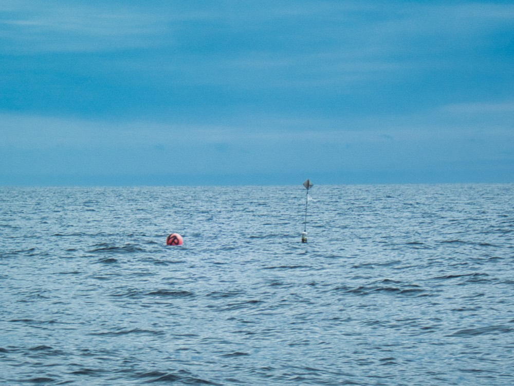
Karen inspects a navigation buoy that appears to be off station.
If you get the chance, go to Sable Island. By far the best way to visit is by private boat. In round numbers, about the same number of people go into space in a year as visit Sable Island by boat! Do the adventure! We found the permitting process to be very simple, and the park staff was helpful and welcoming.