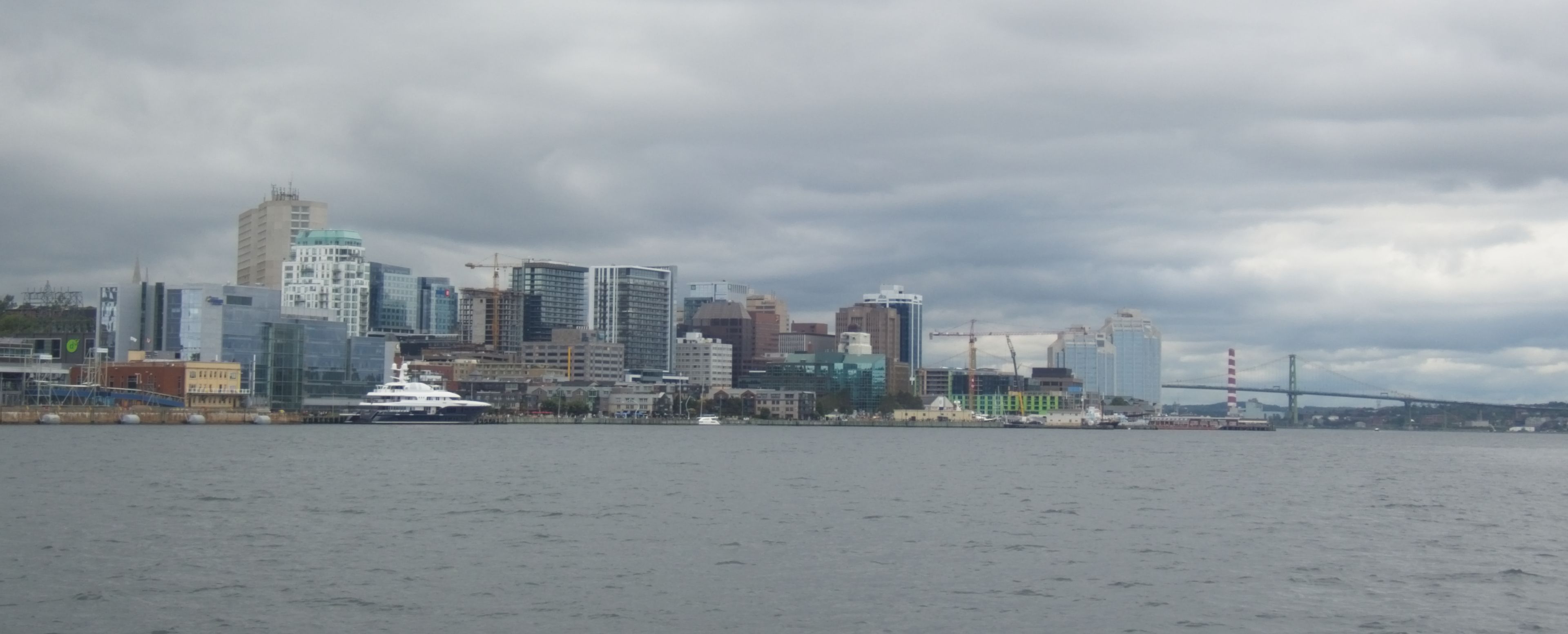
We are patiently (not!) waiting for out package of pump parts to clear Canadian Customs. With no way of knowing when the wheels of bureaucracy will finish turning, we have decided that they will get here when they get here, and if we miss them, we’ll pick them up from the marina on our way back south. So we have stopped back in Halifax to fill our boat for a few weeks away from easy supply.
Passing over the shoals at the enterance of Halifax Harbour the sonar was lit up with so many fish that we had to stop and see what we could see. It took no time at all to discover that the fish were dense schools of “harbour pollack,” which is a polite way to say, small pollack. So many fish, they literally fought over who had the priviledge of biting the hook. We did finally land a cod of a size sufficient to grace our chowder pot for dinner.
We spent the last two nights in an anchorage called “Rouge’s Roost” a small, beautiful, quiet, bay with the narrowest opening we have ever piloted Harmonie through. It was on the very fringes of cell coverage, so we had no practical internet connection while there, which was its own kind of delightful. Back at the bustling waterfront of Halifax, the contrast is entertaining!
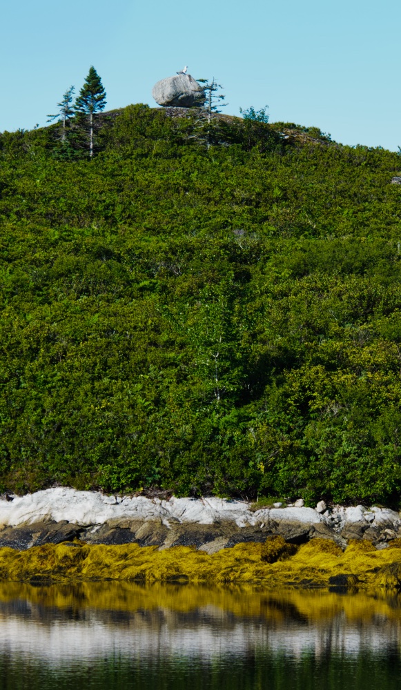
Photographers do not call it “Golden Hour Light” for nothing!“Sisyphus was here!”
Next week–weather permitting–we will be visiting Sable Island. An adventure we are very much looking forward to.
Yesterday was one of those perfect days that cruising is just all supposed to be about. The weather was perfect. Cool morning, sunny warm afternoon without a hint of hot and muggy and, for now, the fog has burned off. The sailing and the fishing are great. The scenery is beautiful, and the natives are friendly.
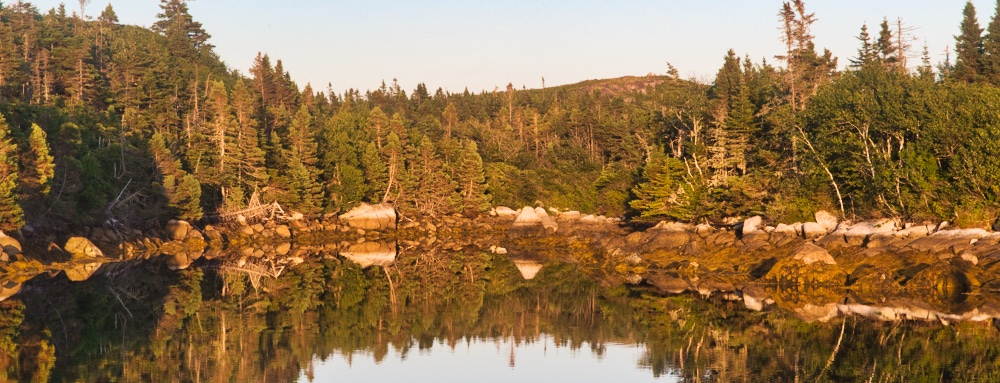
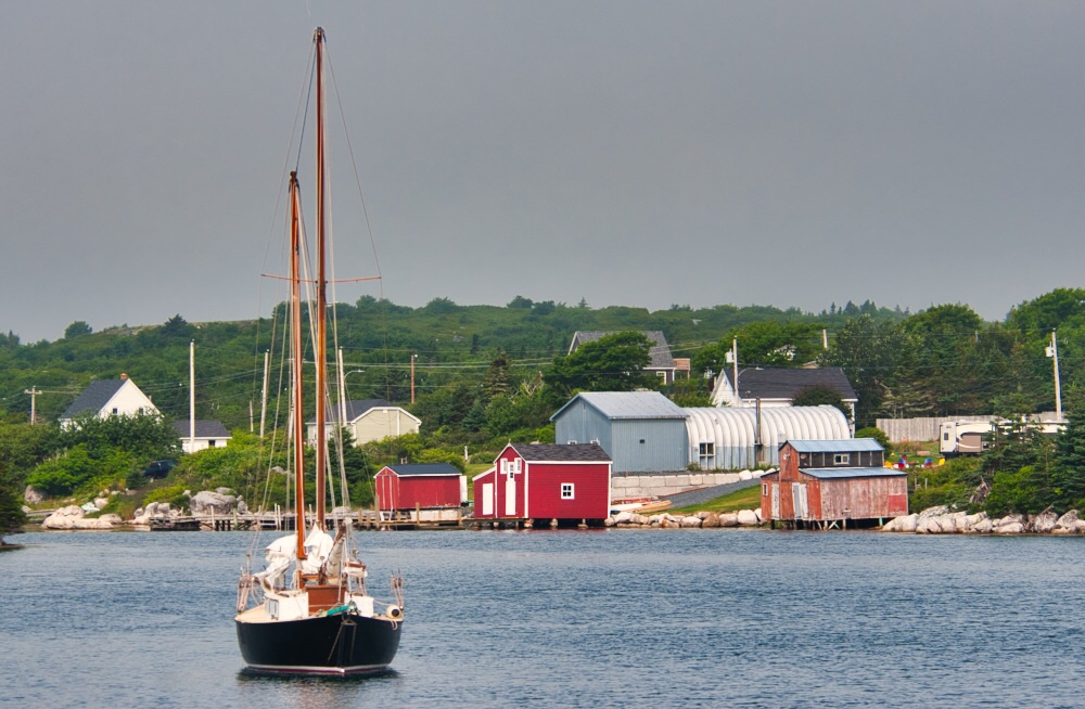
We are now anchored in Indian Harbour, a tiny cove on the eastern shore of St Margaret’s Bay. With care, one other boat might fit in here, but it would be a tight squeeze. The cove is on the east side of Paddy Head Island, and the entrance marked by Paddy Head Light.
Harmonie in Indian Harbour. Paddy Head Island and Light in the background.
To give you an idea of what it’s like cruising here, this spot was mentioned as a good anchorage in our guide book. Not exactly a featured spot, but certainly nothing bad was mentioned. Locals could list off ALL the boats that had anchored here over the last five years. Pretty quiet.
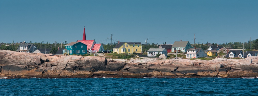
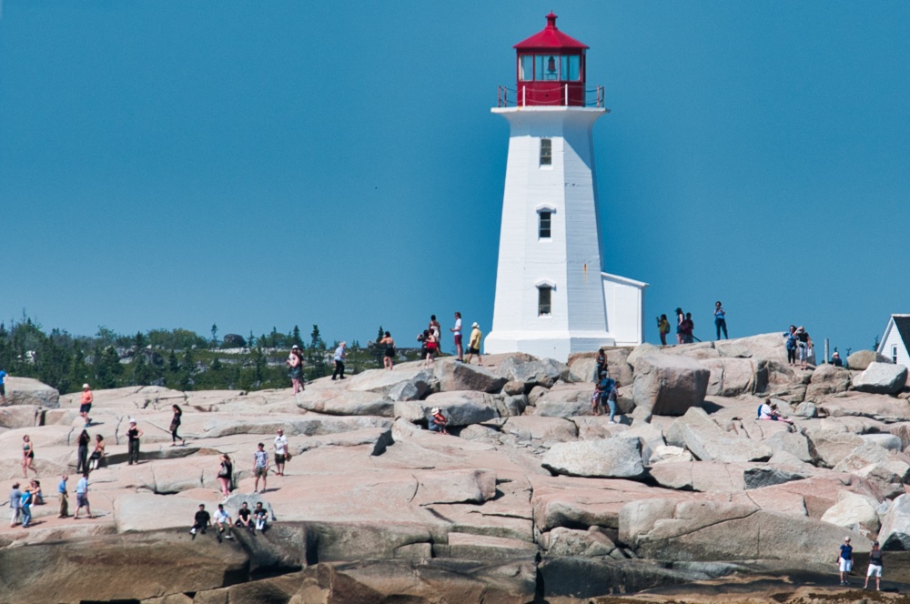
Just a few miles away, at the entrance to St Margaret’s Bay, is what our guide book described as “ground-zero for Nova Scotia tourism.” And as we come around the point, sure enough a pretty, and unusually colorful, village appears, complete with an iconic lighthouse.
Colorful Peggy’s Cove
As we get closer, the one feature that seperates Peggy’s Cove from other small Nova Scotia fishing towns becomes visible: Crowds of tourists. Hordes even. The place is positively infested with them.
Our advice to touring Nova Scotia (or pretty much any other place on the planet!): Avoid places like this. They are pretty and all, but within just a few miles there are a lot of other REAL fishing villages where you will meet real people, and see real things. In their own real-life way they are just as pretty.
How iconic is the town of Peggy’s Cove? So iconic it has been duplicated as a theme park in Chao Lao Beach, Thailand! Billed as an “authentic western fishing village.” Seriously. You could google it.
Outside the tourist meccas, the natives are friendlier than anyplace we have ever been. People come out to your boat and invite you to breakfast, offer a ride to the store, water, whatever they can help you with just because, “you’re a long way from home.”
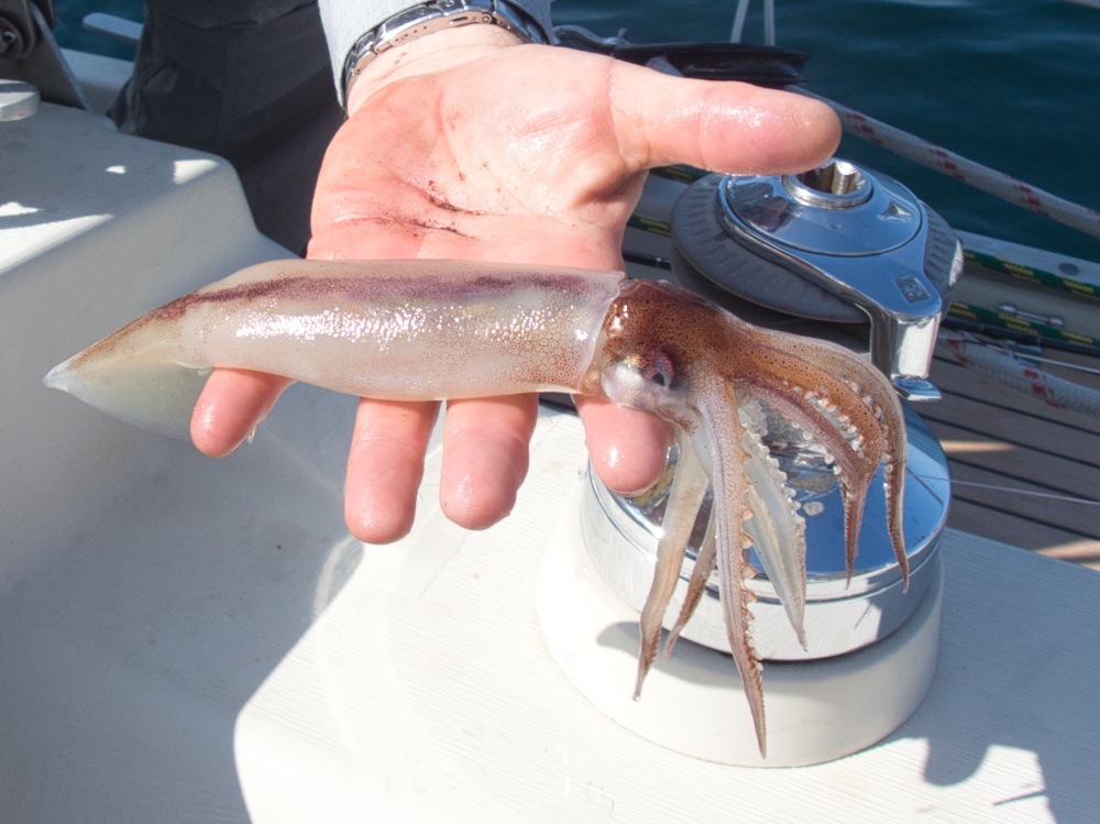
Fishing in these waters is a bit different. They are rich with life. We look for a place where a pile of rocks rises out of a surrounding soft bottom, and there are the fish. So far cod and pollack have been the principle catch, with a few oddballs thrown in for good measure. Because we are fishing close to shore in relatively shallow water, we are catching the smaller fish, but a 5 lb cod, while not a trophy, still puts food on the table. If you put 4 of those on deck, you are headed towards filling the freezer!
Cod doesn’t get any fresher than this.Today’s oddball catch, a squid. Although much more common in the ocean than most people realize, they rarely end up on fisherman’s hooks. Squid like this one probably make up a very large percentage of the diet of cod like those in the previous picture.
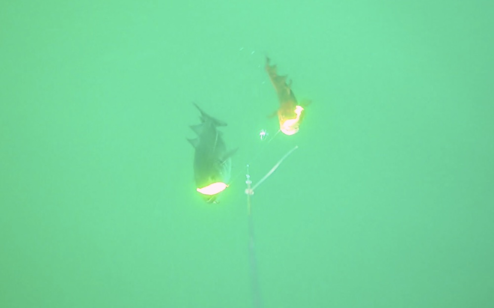
Trying something a bit different, I attached our underwater camera to the line for part of the day. That provided some interesting and educational footage of fish interacting with our lures. I’ll be editing and posting some of that before too long!
A cod and pollack double-header being reeled to the surface, captured by the “Fish Cam.”
We sailed out of Halifax yesterday with good wind, much of the way. Once we reached the mouth of Halifax Harbour, we sailed most of the rest of the way in thick fog. When you are coming into a new-to-you harbour, surrounded by rocks and shoals, and you can not see a boat length in any direction, it certainly increases your appreciation for GPS and RADAR.
We stopped along the way twice to try our luck with fishing, and ended up with a small pollack and a cod. The ocean bottom here is very rough and there is “fishy structure” everywhere. We stop when the sonar shows us dense schools of fish. In many, many places there are huge schools of mackerel and herring. We look for those schools that have bigger fish marks hovering underneath.
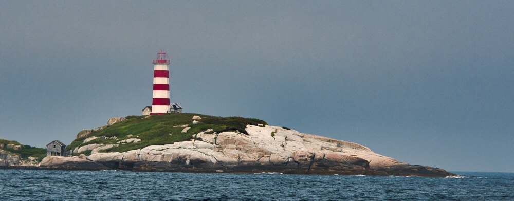
Between Halifax and Sambro there are rocky islets and shoals that extend offshore for several miles. Marking these is Sambro Light. With so many picturesque lighthouses around it is hard to pick a top ten, much less a “best” but this one certainly is in the running.
The fog just lowering on top of Sambro Light.
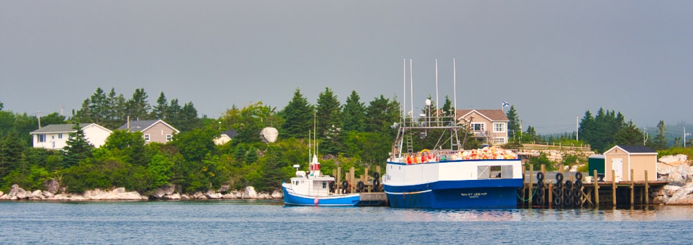
As we sit at anchor here, the surrounding landscape comes, and goes, as small changes in wind and temperature bring the fog in, and then push it back out again. The bay is surrounded by houses and small fish landing operations that seem mostly dedicated to lobster. If you ever meet a Nova Scotia lobster fisherman, be sure to treat him very nicely. No matter if he looks looks it or not, he is one tough hombre. Lobster season here is in the winter. That’s some seriously tough work.
In the cruising guides Sambro Bay does not get high marks for scenic beauty. But it ain’t too shabby looking!
Georgia is 159 feet of luxury, and is for sale. She can be yours for $13,000,000.
We have been enjoying life on the town for the past couple of days, and were expecting to leave this morning, but we got elbowed out of the line for refueling by a little boat named Georgia. A 159 foot yacht that I imagine is a far more profitable trip for the fuel truck!
We are making our preparations to run around the corner to the “fuel dock” which is basically a spot along the seawall where the truck can pull up and reach with his hose. Once we top off our tanks, we’ll be back here, and then leave first thing in the AM.
Karen was just chatting with one of the local harbour pilots who came by to say hello. It turns out he did a crossing of the Pacific on an Amel, so she got some high quality local info from him. He suggested that if we wanted to catch some fish, we just stop at any of the shoals and start jigging. We’ll certainly be giving that a shot in the next few days.
We had applied with the Park Service for a permit to visit Sable Island, a sandy little speck of land 100 miles east of the coast. Definetly far, far off the beaten track. Uninhabited except for a small park staff and a herd of wild horses. We were excited today to get notice our application was approved! It’s a big deal, for many years the island was completely off limits to all visitors. These days almost all the visits are by small plane. An 8 hour visit on the charted plane costs $2500 and are available only a half dozen days a year. If the weather cooperates, we’ll be out there in about 2 weeks. A few days there will cost us nothing more than the time to get there.
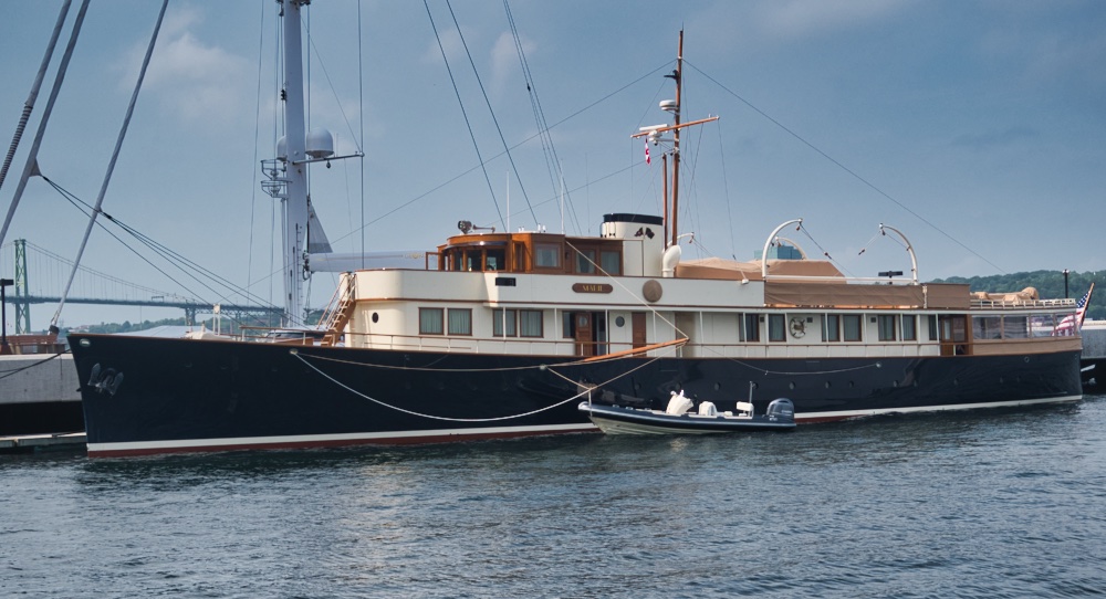
Another, even more beautiful boat. 130 foot long Marie was built in 1930. Twenty years ago she was a derelict and her steel hull was scheduled to be cut up for scrap. She was rescued, and restored to a level that is above and beyond museum showpiece standards.
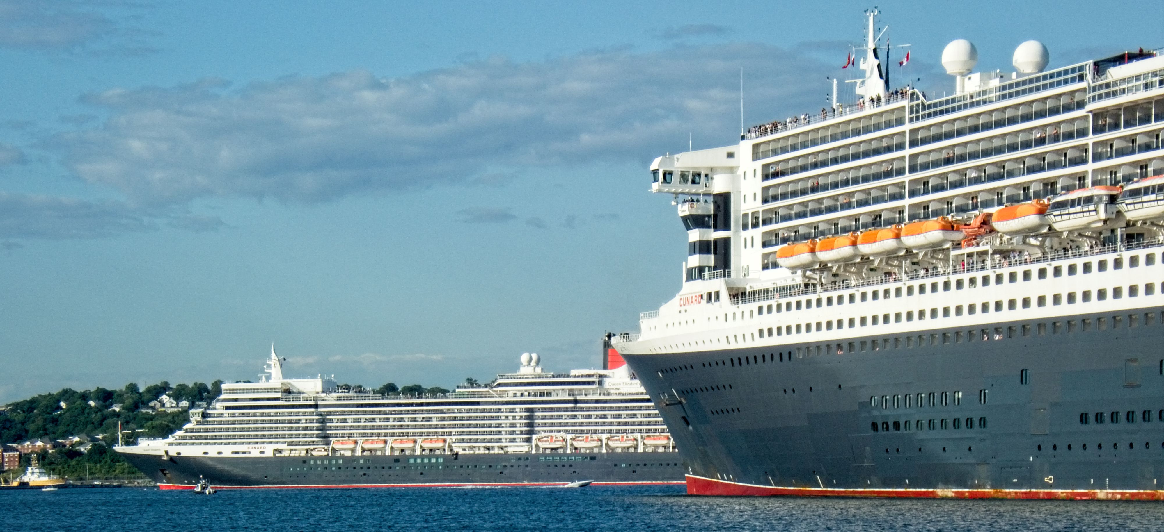
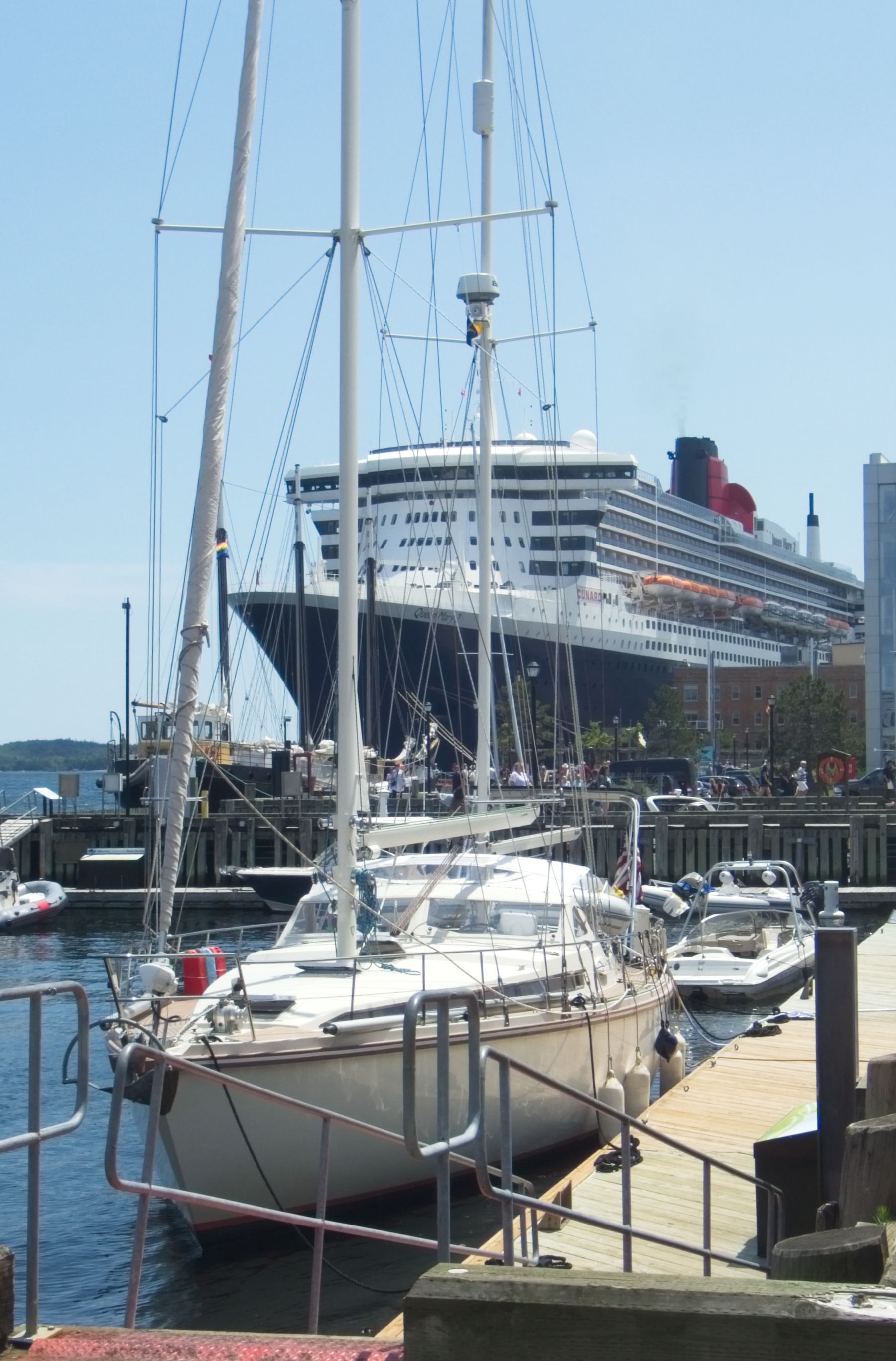
Today was Big Entertainment in Halifax. How big? REALLY big. Like 1000 feet long times two! The cruise ship the Queen Elizabeth and the Liner(1) Queen Mary 2 were in port here on the same day. These are the two largest ships in Cunard Line. Samuel Cunard was a native Haligonian. Kind of a local kid who made good 175 years ago, and the locals still have a warm spot in their hearts for Cunard ships (even if these days they are owned by Carnival!)
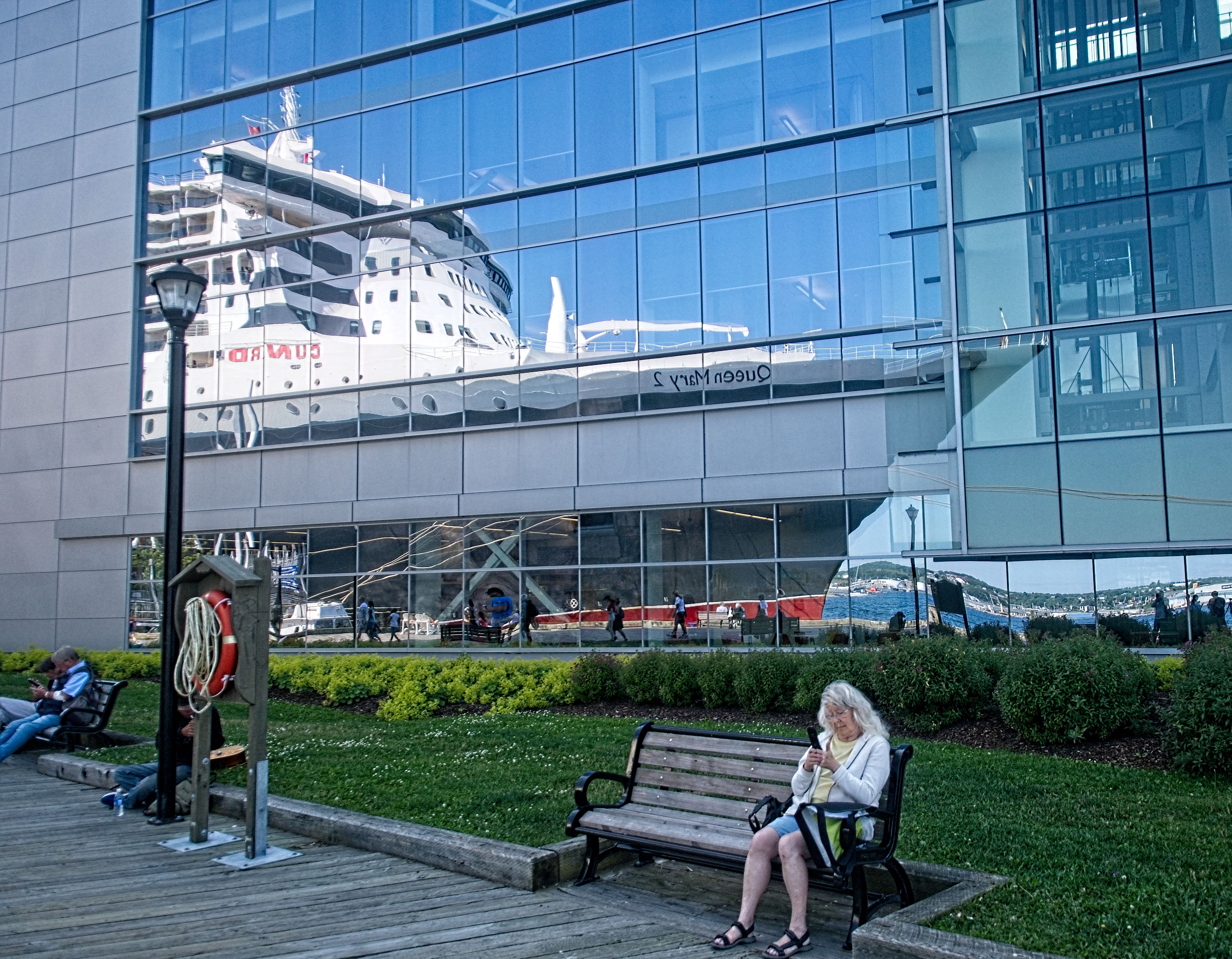
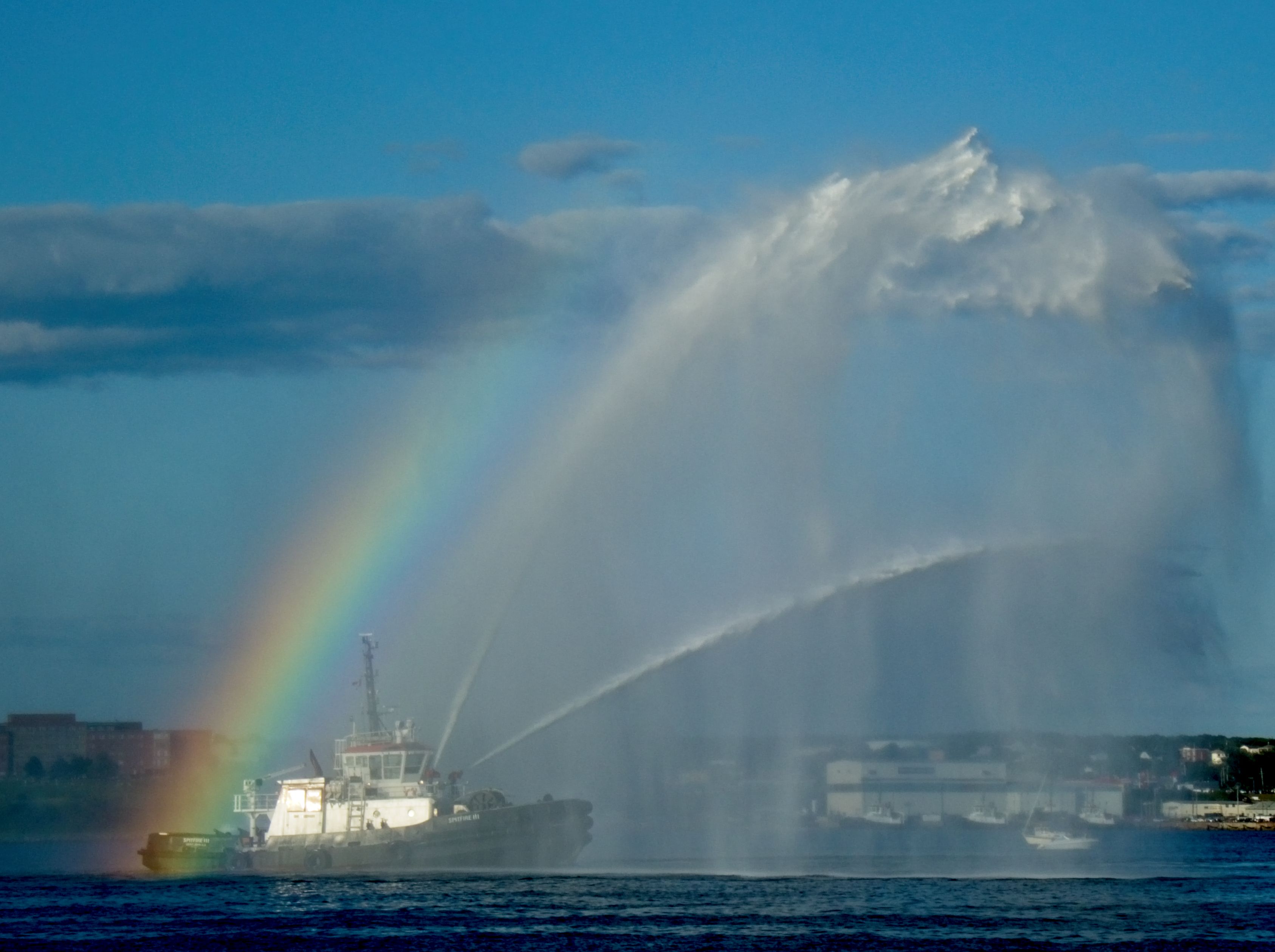
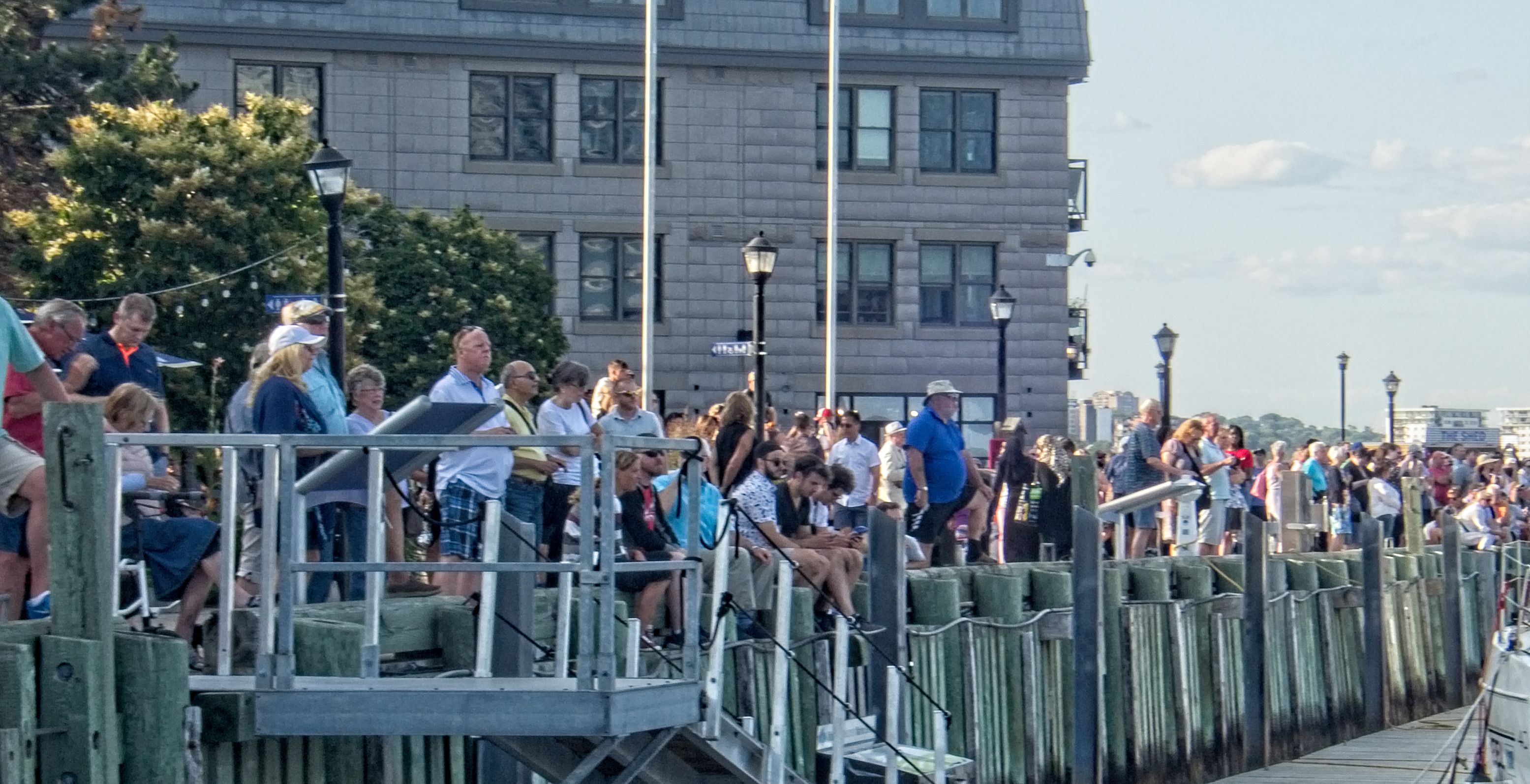
That’s the Queen Mary 2 in foreground, and the Queen Elizabeth in the background.When every camera is pointed one way, sometimes the most interesting photo can be had by turning around…When you have special nautical visitors, you have to have a marine parade. And what’s a marine parade without fireboats?Both huge ships left the dock at 6PM and did a slow circuit of the harbour which attracted quite a large crowd to the waterfront.That would be OUR cruise ship in the foreground.
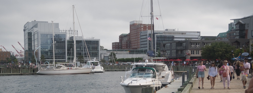
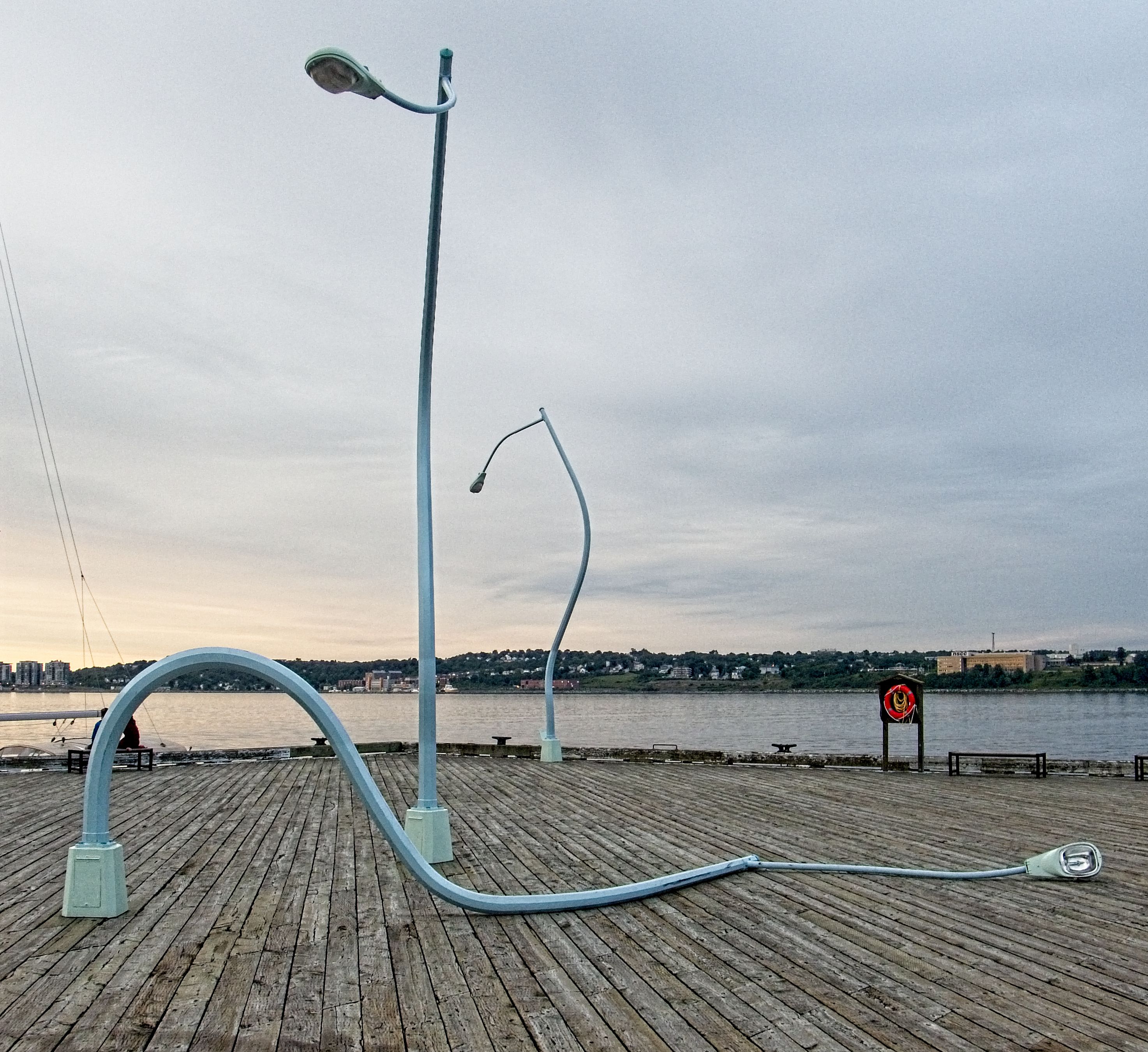
For those few of our readers who might be familiar with Halifax we are docked at Bishop’s Landing, right in the middle of the waterfront district. It is really a delightful stop. The people are delightful, and the weather has been wonderful. The locals insist it is “hot.” How hot it is?
It is SOOO hot the streetlights have all melted! (Actually it is only 79ºF. Hot for the locals, cool for us!)
In other news…
Our post-voyage survey found a couple problems onboard Harmonie. One of our two parallel fresh water pumps had a dead electronic control unit. We have one arriving in a few days here. We also found that we have a failing rear seal on our transmission. Since that repair requires a full disassembly of the transmission, we are going to nurse that along for a while, while keeping a close eye on it.
Notes:
(1) What’s the difference between a Cruise Ship and an Ocean Liner? A “Liner” has a scheduled route between two points. The Queen Mary 2 runs scheduled service between Southampton, England, and New York in the summer. The rest of the year it runs a cruise schedule, including round the world trips. She is headed back to Southampton via Iceland to complete this year’s circumnavigation and start her summer runs between England and New York. It is the last of the great North Atlantic Liners.
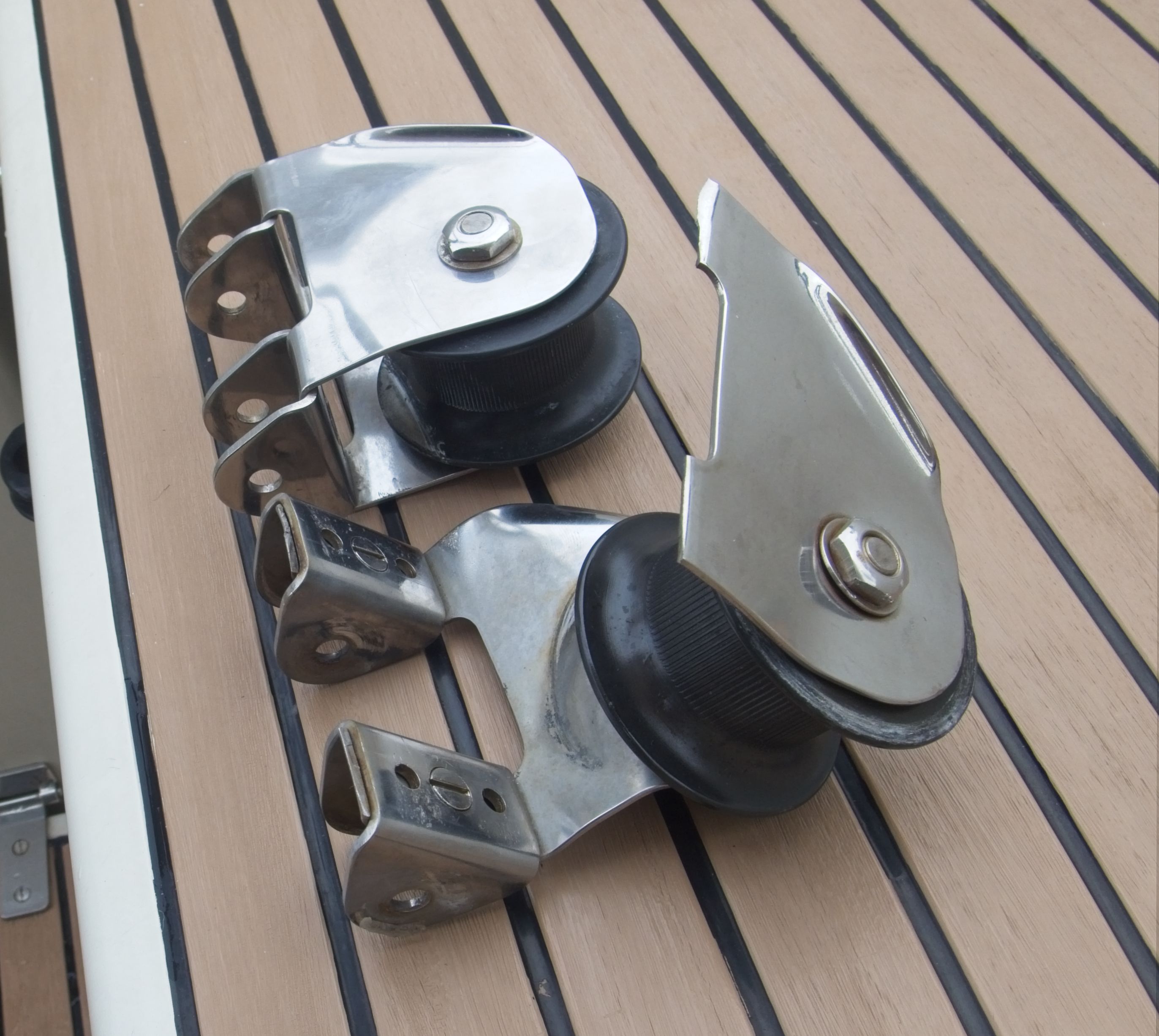
Stainless Steel: It might just be the worst boat metal possible. At first glance a good grade of stainless steel looks like almost the perfect boat metal. Under most conditions it doesn’t rust, even if it does, it is usually just a touch of surface color that an engineer would call “rouging.” It is strong, hard, and shiny. Very shiny.
Unfortunately, the shininess of stainless steel hides a dirty secret. Catastrophic failure can occur at loads far less then the part was designed for, without warning, and on a part that looks to the naked eye to be as good as new. This ability to hide an approaching total failure behind a veil of “shiny” is what gets stainless steel my vote for the “worst boat metal possible.” Since stainless steel is used to make make many “mission critical” parts of a sailboat such as rigging and chainplates, this is not an insignificant problem.
This is a case study of a such a failure.
The Story
Harmonie is a 25 year old, 53 foot ketch. She has been sailed extensively during her life, chalking up two circumnavigations. She has been owned by knowledgable owners who have taken very good care of her.
Hmmm… We seem to have a problem!
While sailing offshore on a close reach in 16 knots of wind and light seas a loud “BANG” announced the problem. It didn’t take long to find it: The jib sheet car had failed, releasing the sheet from under the sheave. As far as I know this part was original to the boat, and is 25 years old. It had been visually inspected as part of the normal routine before this trip, and looked fine. How could a part that had worked for so long, fail under such relatively mild conditions?
What Happened?
The culprit is called “Crevice Corrosion,” or “Corrosion Cracking” or “Stress Cracking.” It is a complex problem, without simple solutions. Sometimes, with careful inspection, it can be seen happening, but often it is invisible to the naked eye until failure (as in this case.) Let’s have a close look at the failure.
Here is a photo of the good, and the bad. We’ll get to the ugly bit in a minute. This is a very heavily loaded piece of hardware. Loads on the line pulling upward on this block can approach 2 tons.
The normal configuration of this part is in the background, and the failed part in front. There are three load-bearing stainless parts. One piece bent upward into a “U” shape that holds the axel for the sheave, and two parts bent downward that transfer the load to a hinge pin. If we look closely at the two legs that have failed, we can see a difference. If you look closely you can see that one leg shows evidence of distortion under load with ripping and tearing of the metal, while the other leg looks like it just came apart with no stress, as neatly as a piece of paper cut with a razor.
A Closer Look…
This is the front leg of the broken part. The area circled in red is obviously fractured and torn metal. It is bent, rough, granular, and shiny. The rest of the failure face looks different. We get a better idea of what this means if we look at the other leg…
This looks rather odd for a stainless steel part that was separated only two days before. It is dull, grainy, even rusty in spots. It has an odd pattern of lines almost like tree rings.
If you look very closely you can see a very narrow line of shiny, fractured metal along the outer edge of the part, a fraction of a millimeter thick, which is slightly wider on the right side of the picture. The interesting thing is this tiny, little bit is the only part that could actually seen when visually inspecting the part. Everything looked fine, even though the effective width of the metal holding things together was reduced to less than 5% of its original thickness!
Why Did It Happen?
The following description is not intended to be an exact description of the chemistry that occurs, but to give you a feel for the issue. Stainless steel contains a significant about of chromium. Chromium reacts rapidly with oxygen in air or water to form chromium oxide, a very hard material that seals the surface of the stainless steel and prevents the oxygen from attacking the iron and other components of the alloy. The key part of this story is that without oxygen, chromium oxide can not form, and the alloy is susceptible to various different types of corrosion, especially attack by the chloride ions in seawater.
Imagine we have a tiny crack or other surface imperfection in a stainless part. The bottom of that crack is not well flushed with air or water, and becomes deficient in oxygen, and the very bottom of the crack begins to corrode and become weaker. If there is also stress on the part, the crack grows, and continues to corrode and grow, corrode, and grow… It might happen very slowly, but once started, it inevitably continues to grow until the part fails. The warmer, and saltier, the environment the faster the failure progresses.
The dull, rusty appearance of the fracture surface of our failed part shows us the extent of the crack before the part failed. Almost no metal was left to carry the load! The lines of “tree rings” shows the slow growth of the crack over time. Both legs of this part show the effects of this type of failure happening. It was more advanced in the rear leg because that is the one under greater tensile stress in normal operation.
The initial crack can come from lots of things. In this case, probably from stresses in the part when it was bent as part of the original fabrication. Stainless steel that is covered in some way that prevents access to oxygen can develop pits, and those pits can then form the starting point for cracks. Even something as simple as a piece of tape left on long enough, under the wrong conditions, can start this process.
Bolts are especially susceptible to this kind of failure because they are under constant tensile stress from being tightened, and the base of the threads form stress risers where cracks easily start. I have seen bolts securing the chainplates of a boat have the nuts literaly fall off from crevice corrosion.
Can It be Prevented?
The only real prevention for this kind of failure is in the initial design of the part when stresses can be minimized, and alloys chosen that are less susceptible to the problem under conditions that are expected to be encountered. Pretty much out of your hands as a sailboat owner.
If you have the opportunity to specify a stainless stell alloy for your boat parts, here is a list of common marine alloys in increasing order of resistanct to corrosion craking: 18-8, 304, 316, 316L. 316L is the best of the normally available alloys in this regard, but it is still not proof against this kind of failure. And proving that you never get something for nothing, it also has significantly lower tensile strength than 304. I have not found anywhere the manufacturer of this part spcifies the stainless alloy they used.
There are ways to inspect a part that make this kind of failure easier to see. Polishing the part and inspecting with a highpower (30-60X) loupe can help you find a crack as it starts, although they are so subtle it can take practice, and it can be exceedingly tedious to completely inspect a large part this way. There are penetrating dies, and magnetic flux tests, even x-rays. However, they require access to the part and usually full disassembly which was not possible in this case.
Stainless steel in life-critical installations on a boat in a marine environment needs to be carefully evaluated for the possibility of failure and the potential consequences. Regular dye testing or pro-active replacement on a conservative schedule are not unreasonable for parts whose failure could put the boat or the crew at serious risk..
Specific Lessons Worth Learning
In the very specific case here: These jib cars are a standard design from Antel. Looking at these, knowing their age, and the damage I see, it seems reasonable to me that a ten year life should be expected. Beyond that, you’re living on borrowed time. It seems unlikely that the failure of these parts could cause a situation that was immedietly threatening to the crew or the boat, but if it occured in the middle of the night, during a storm, halfway across the ocean it could be… very inconvenienet!
This kind of failure is why stainless steel just does not belong—ever—as the material of construction of an anchor chain or anchor. There is simply no way that every link in an anchor chain could ever be inspected closely enough to catch an incipient failure. This kind of problem does not happen with the kind of galvanized steels used in anchor chain. The only way to be safe would be to discard a stainless steel chain before it developed cracks like this, and I know of no way to predict its lifespan.
Given that corrosion cracking is so hard to detect visually, you should always be suspicious of anyone who does a rigging inspection and pronounces it “Good for another 10 years.” This is only one of several reasons that stainless steel rigging NEEDS to be replaced at reasonable intervals to avoid sudden, unexpected, failure, and the unpredictability of the problem is why people argue endlessly over what that interval should be.
We arrived here in Halifax yesterday afternoon, and have a dock right downtown in the heart of the city. Checking in with Canadian Customs and immegration was a simple phone call. The only isse was that we were ordered to make sure we did not allow our apples ashore.
We are docked alongside a long waterfront promenade that is popular with locals and tourists and is the center of downtown activities. As I write this we are being serenaded by a street musicisan playing jazz standards on a bass clarinet.
We are enjoying cool weather here, although the locals are complaining about the heat. We’ll be here for a day or two, and then head north along the coast.
Now that we have a real internet connection, here are some of the pictures from our 5 day voyage up the coast to Nova Scotia.
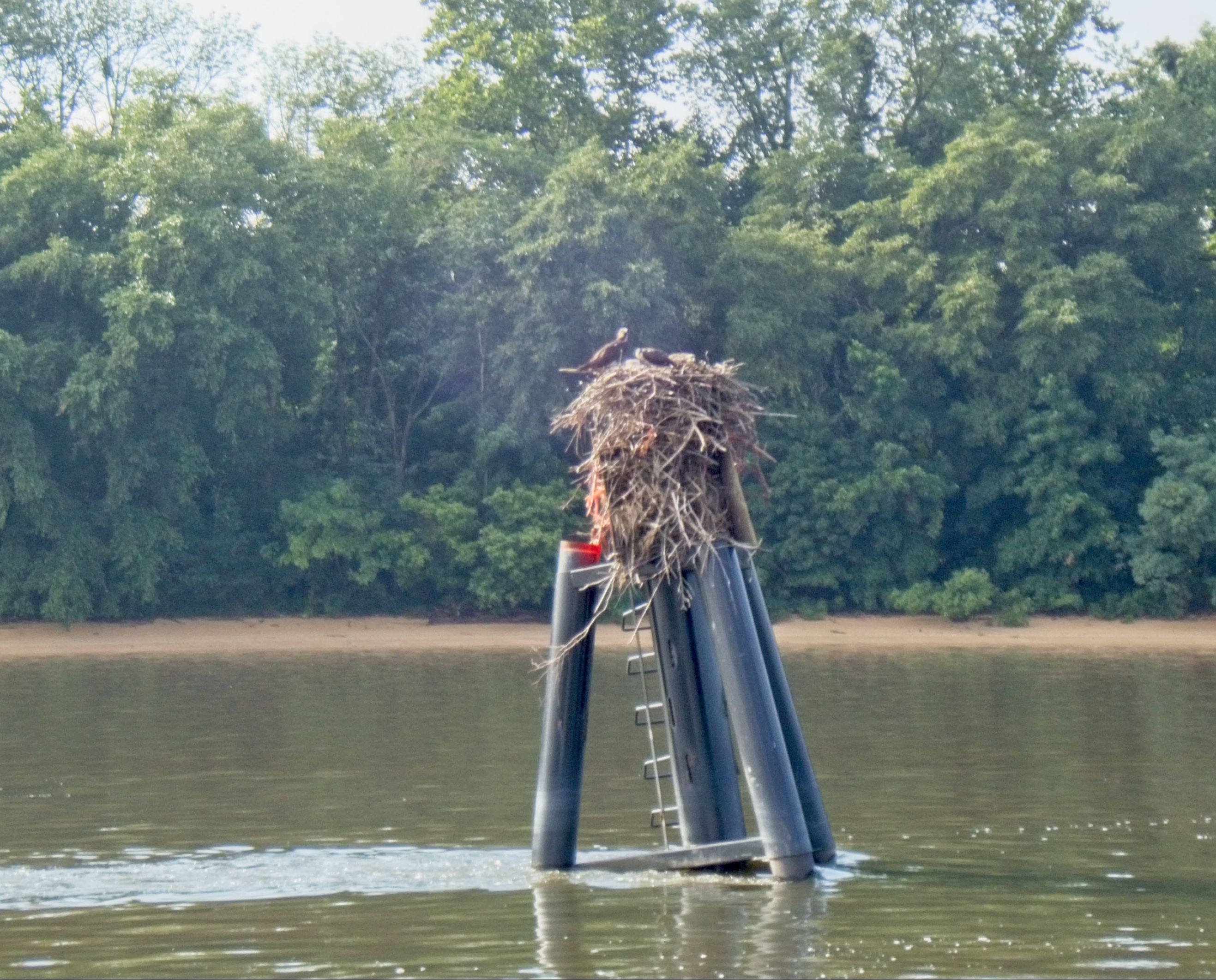
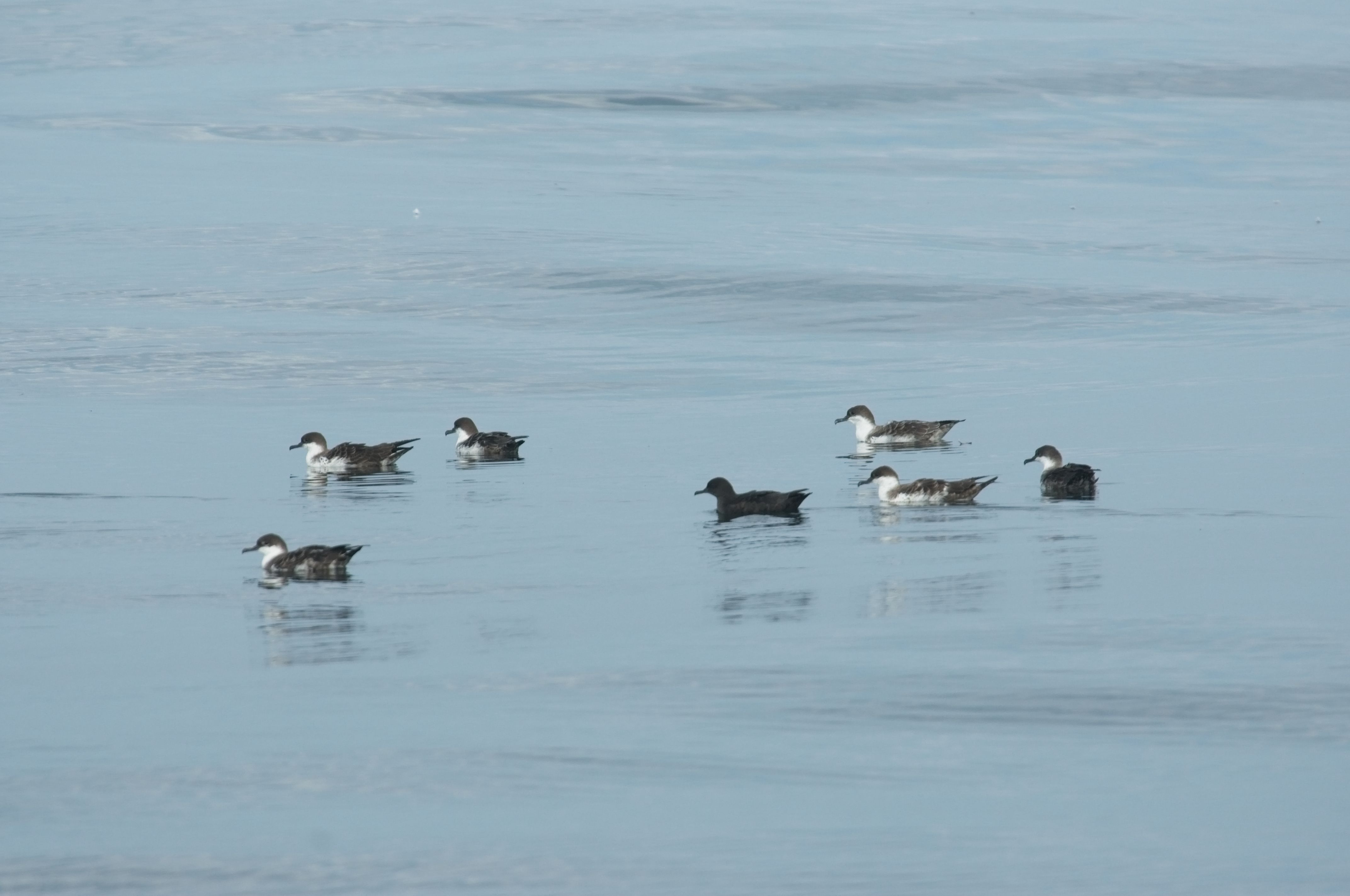
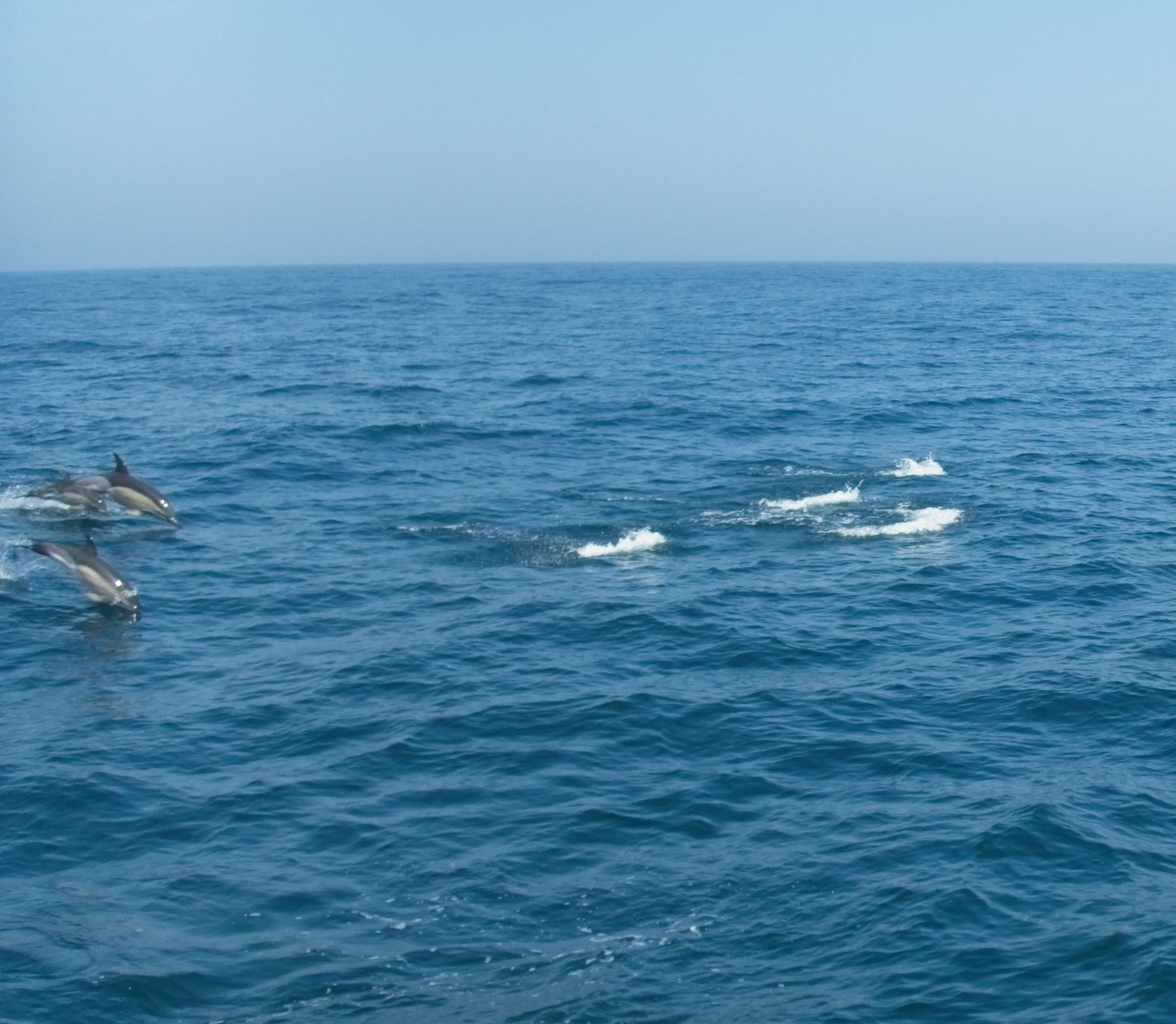
Motoring through the Chesepeake and Delaware Canal is pretty… and rather boring.Crossing the Chesepeak and Delaware Canal is something that at first glance looks like a power line, but in acutallity is a natural gas pipeline!Osprey return to the same nest year after year and keep adding to it. This is one of the biggest we have seen. Somewhere buried under there is a channel marker!Although the Chesapeake is famous for its lighthouses, the Delaware has some pretty ones too.Shark! No… wait… not a shark, but an ocean sunfish. A Mola mola, the largest bony fish in the ocean, and surely one of the strangest.I am not even going to try to identify these birds beyond calling them shearwaters. Our book on the seabirds of the worlds lists dozens of different species, most of them so similar you would hve trouble with a confirmed id even if you had the bird in hand!A harbor seal checks out Harmonie as she motors by on a glass-calm sea.Our only significant gear failure on this trip, a jib block that spontaniously self-disassembled due to crevice corrosion. We’ll have more to say about that in a future posting! Fortunetly, we have spares on board for this part.Common dolphin come racing past Harmonie.Downtown Halifax.
05:05 local, 23 July 2019
Lat: 43° 58.4’ N
Lon: 64° 18.9’ W
Weather: Overcast, scattered rain, wind 14kt, NE
Water temperature: 64°F/Air temperature: 58°F
Course: 072M
Speed: 6.1kts
Distance from Delaware Bay Entrance: 578NM
Distance from Halifax Harbor Entrance: 46NM
We are closing in on the port of Halifax, ETA 14:00. The fourth day of a passage is about when we get fully into the rhythm of watch schedules and underway life. Despite that, we are both very much looking forward to an uninterrupted sleep.
There has been lot more wildlife to see. We are learning that the best viewing here is near where water temperatures are changing, and they change a lot here! In the last 12 hours we have seen water as cold as 46°F, and as warm as 64°F. Many more birds, mostly shearwaters and storm petrels. Harbor porpoises, harbor seals, and pilot whales have rounded out the visible critters.
The pilot whales were in a closely packed group of about a dozen, cavorting on the surface for about 10 minutes before diving as a group to feed in the 800 feet deep water. After about 10 minutes they would reappear very near where they dove. It’s a pretty typical place to find pilot whales: deep water, yet near land. They live all over the world. The last time we saw them was in the Molokai Channel in Hawaii’.
Because it was calm and the whales were close, we tried to launch the drone to get pictures of them. We didn’t quite get our act together quickly enough before they moved on. We also learned a lot about launching and recovering the drone from a rolling and pitching boat. I learned how to drive it, Karen learned how to catch it, and to keep her fingers away from the propellers (Ouch!). We’ll be better next time, or if not better at least faster!
After 36 hours of motoring through flat calm seas, we finally have some wind, unfortunately it it dead straight on our nose. For now we have decided to continue to motor into it which will save us several hours. That decision might change if the waves build, or the wind direction shifts a bit.
07:00 local, 22 July 2019
Lat: 42° 31.5’ N
Lon: 66° 50.6 W
Weather: Partly cloudy, wind 4kt, NE
Water temperature: 64°F/Air temperature: 62°F
Course: 066M
Speed: 6.8kts
Distance from Delaware Bay Entrance: 435NM
Distance from Halifax Harbor Entrance: 186NM
We have been motoring since midnight, and the forecast is for continuously light winds for most of today. We continue to be on target for a tomorrow afternoon arrival in Halifax.
We are now in Canadian waters, and stowed the fishing gear until we have check in with customs. We didn’t get as much chance to fish on the way here as we had hoped. Either the wind was blowing to hard to fish deep, or we just weren’t in a good spot.
We have just past a pair of harpoon boats. I have seen this kind of fishing boat in harbors, but never out fishing. Characterized by a very long and narrow bow pulpit where the harpooner stands waiting for the boat to either chase down, or sneak up on, its target. He throws the harpoon, which is attached to a large float. They then chase down the float when the fish tires. Swordfish and giant bluefin tuna are the usual catch.
We had a clear day and night, but there is a gray wall ahead of us, so I suspect we’ll be listening to the foghorn again in a short while.
Water temperature around here changes dramatically, and quickly. We have seen changes of up 10°F in a few minutes. The proximity of deep cold water with the filling, and emptying, of the Bay of Fundy every 6 hours I am sure have something to do with that. Where the water is cold, it is foggy. Where the water is warmer, it is sunny and warm.
05:30 local, 21 July 2019
Lat: 41° 05.7’ N
Lon: 69° 10.5 W
Weather: Dense fog, wind 16kt, SW
Water temperature: 57°F/Air temperature: 52°F
Course: 055M
Speed: 4.5kts
Distance from Delaware Bay Entrance: 301NM
Distance from Halifax Harbor Entrance: 321NM
We spent the day yesterday sailing or motoring downwind. It was hot, and humid. The ocean appeared almost empty. We saw no birds. For most of the day we traveled across a flat ocean bottom 200 feet deep, only rarely marking a fish on sonar. We sailed. We sweated. Did I say it was hot?
As we approached Nantucket, we saw a disturbance on the water surface a good distance away. Spray, foam, splashing. Thinking we were seeing feeding fish, I started to turn the boat that way. It quickly became obvious that what ever it was was coming toward us. Directly toward us. Fast. Soon we could make out the individuals in a school of 100 or more common dolphin. A school of dolphin who obviously wanted to be somewhere very special, as quickly as possible.
Harmonie was directly in their path. For a few seconds we had dolphin in front, behind, and under us. They were on a mission. Without slowing down, they continued as if we weren’t there, and a few minutes later disappeared off to the Southeast, never varying from a straight course to—somewhere.
Shortly after, we came across a large group of birds. More than we had seen the whole trip so far. Mostly just sitting on the water surface. A group of them started to follow us and show an unhealthy interest in one of our trolled lures. Even diving at it. This is unusual, birds are usually smart enough to avoid a artificial lure (not always!). When I brought the lure in to avoid hooking a bird, we discovered the source of the attraction. About a freshly hooked 2 pound mahi-mahi, too small to pull out any drag or even bend the rod.
A few minutes later, we noticed the water temperature gauge had dropped from about 76° to 66°. As the sun set, the water temperature dropped again, down to 60°. Now fish are everywhere on the sonar. It’s a very different ocean than we were in two hours ago!
As that hot, humid air blows northward and encounters the suddenly cold water, it cools quickly. All that humidity can no longer stay as water vapor, so now it is water droplets, I.e., fog. Our visibility is down to about 50 yards. Our foghorn and a close watch on the radar are suddenly very important.
We just crossed the last major shipping lane until we approach Halifax. As intimidating as the large ships are in the near zero visibility, the smaller fishing vessels are more difficult to deal with. Because of their work, their movements are much less predictable, and—sometimes—they are much less professionally run.
The last leg of this voyage is now a straight shot to Halifax, or as straight as wind allows. Hopefully we have weather that will allow us a fishing stop on Georges Bank. Cod, haddock, and pollack seasons are open out here, and if we are incredibly lucky we might tie into an Atlantic halibut.