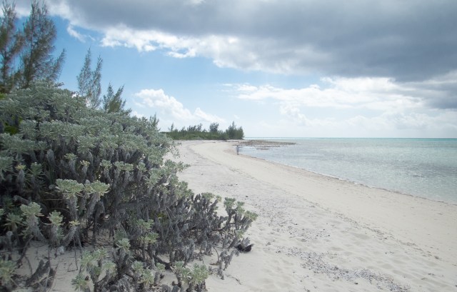
Nothing to see here…

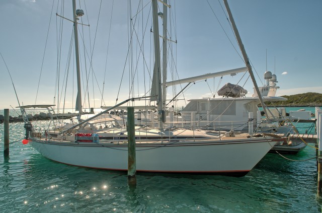
Harmonie is tied up at the Grand Bahama Yacht Club.  We are 100 miles away in distance, and a thousand miles in other ways.

We hoped on the ferry from Freeport to Fort Lauderdale (about 3 1/2 hours).   The ferry is interesting.  Run by a Spanish company, it is a fast wave piercing design that travels at about 25 knots.  The clientele were a mixture of Bahamians making a quick one day trip for shopping, others on longer term trips visiting families, and a large number of tourists. A significant fraction of the tourist traffic were Europeans.  I am guessing they are just more likely to consider non-airplane travel. Over all it was an experience we enjoyed, and was in a door to door travel time not much different than taking a flight, and a lot cheaper.  There is also ferry service to Miami.

Ferry Pros:

  • Way more room than a plane. Walk around all you want. Outside if you like.
  • Less boarding hassle.
  • Cheaper.
  • Better views.
  • Dedicated customs clearance.  (Have you ever cleared into the USA at the Miami airport on a busy day?  Yuch!)

Ferry Cons:

  • A bit slower at 3 1/2 hours for the crossing.
  • Limited schedule.  One round trip a day, on most days.

We’ll be in Florida for 10 days or so.  For a few days we’ll be in Hollywood taking care of business, then a fun day or two at the huge Miami boat show, then down to Big Pine Key to visit friends.  All the while picking up boat parts and supplies.

IMG_5850

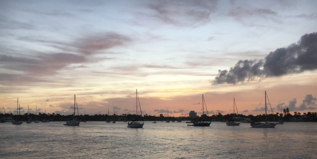
Sunset over North Lake, Hollywood, Florida

Posted in Underway | 2 Comments

What is special about Great Guana Cay?

First, an observation:  Has anyone else noticed how many of the islands of the Bahamas include “Grand” or “Great” as part of their official name?  In the case of Great Guana Cay, we pretty much agree, it is a pretty great place.

Along the northern and eastern edge of Great Abacos Island is what the locals claim is the world’s third largest barrier reef.  Number 1 (Australia) and Number 2 (Belize) everyone agrees on, but the title of Number 3 seems up for grabs by any number of tourist boards.  No matter it’s ranking–it is a special place.  Between Great Abaco Island and the various reef islands offshore is the Sea of Abaco.  Shallow, but not TOO shallow, with great tradewind sailing, and beautiful scenery. After we left Lynyard Cay we sailed up the Sea of Abaco to the barrier island of Great Guana Cay where we picked up a mooring for a few days.

This was truly one of the beautiful places.  While tourism is important, it has none of the tacky flavor that haunt so many tourist places.  It is pretty, and “real”. Also just a 30 minute ferry ride to the large town of Marsh Harbour where we did our grocery shopping.

IMG_0926

This is the ocean side beach on Guana Cay.  A beautiful beach, but maybe a bit crowded?

IMG_0929

How slow is life on this island?  Slow enough that Sunday church services are cancelled…

IMG_0916

The main harbor is the center of town and just beautiful.

img_0925.jpg

The quintessential beach bar…  “Nippers” faces the Atlantic.  On the bay side there is another popular bar “Grabbers”.  Not sure if the names are indicative of a theme or not…

IMG_0919

All the parts of town we saw were just neat, clean and pretty.

Our next goal is to head back to the big city of Freeport, where we will leave Harmonie for a few days while we take care of some business in Florida.  This means retracing our steps back down, and around Great Abaco Island.  We have only just started to appreciate that cruising the northern islands of the Bahamas is a very seasonal thing.  Just a few weeks 2 weeks ago anchorages that we shared with one other boat, now are packed with 10!

We retraced our steps, back to Lynyard Cay, and then south to Sandy Point.  In especially delightful weather, we paused to fish for a bit at one of the local deep reefs and quickly picked up a pair of grouper for dinner.  As we drifted off the reef into very deep water, we were visited by a 10 foot long bull shark who stayed just long enough to make sure we were not edible.  After he left, we were visited by a small school of mahi-mahi.  I had no luck in getting them to bite, but the fresh grouper made a delicious dinner.

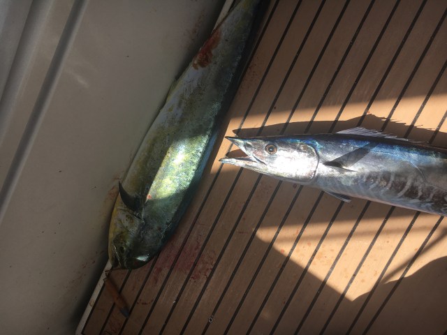
The last leg of this trip was a delightful fast 50 mile sail from Sandy Point back to Freeport, highlighted by a fishing double header, a mahi-mahi AND a wahoo on the lines at the same time. Neither was especially large, but that’s ok because we didn’t have a lot of room in the freezer!

IMG_7784

Two of the best eating fish in the ocean! (Mahi-Mahi left, Wahoo right)

We are back in Freeport now, and will be taking the fast ferry to Fort Lauderdale in a few days.  In the meantime, tomorrow is the local Junkanoo Festival. A carnival type celebration that we expect to be a lot of fun!

Posted in Underway | 3 Comments

Lynyard Cay

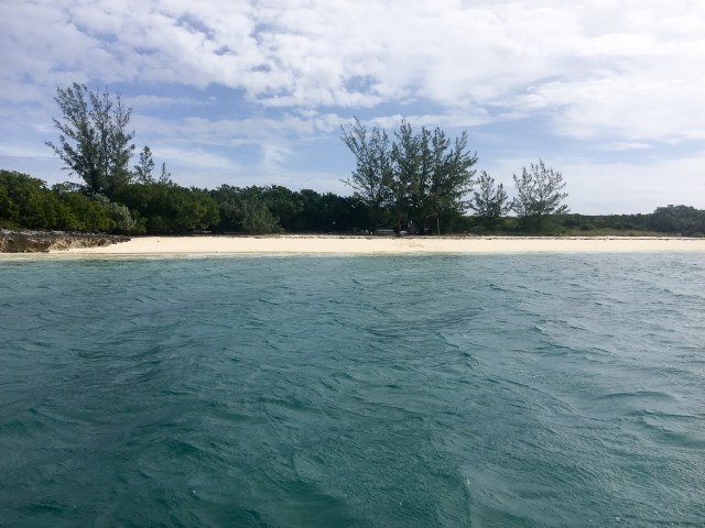
Most of the eastern shore of Great Abaco Island is protected by a line of small barrier islands and reefs.  one of the larger of these is Lynyard Cay.  Occupied only by a single fancy vacation home on the north end, it is quiet and beautiful.IMG_6963

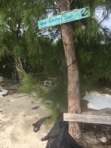
IMG_2883We put ashore at Uncle Charlie’s Beach.  We have no idea who Uncle Charlie was, or what he did to get a beach named after him, but it sure is a nice place.
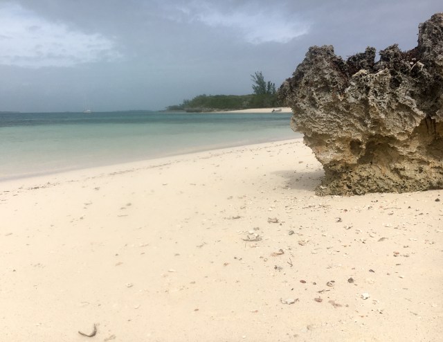
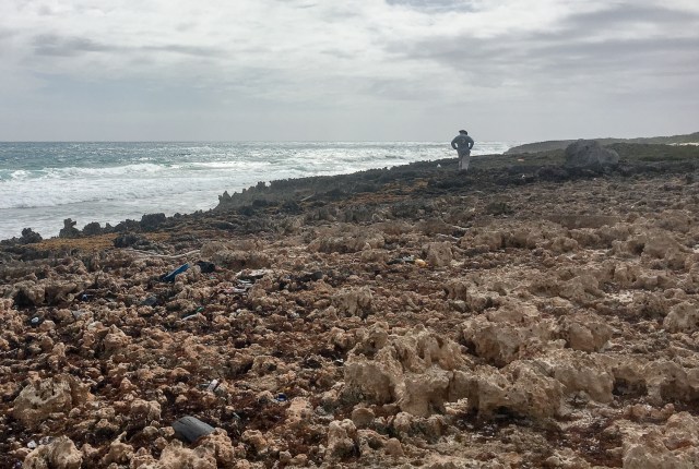
The island itself is mostly exposed weathered coral rock.  Rough, hard, and very sharp, it is nasty stuff to move around on.  Do NOT fall, or you be in a world of hurt.

The two sides of the island are different worlds. The west (lagoon) side is quiet and peaceful with several sand beaches where tiny waves lap gently.  The east (ocean) side is mostly naked coral rock pounded by large ocean surf.

IMG_8347

Lagoon side. Quiet, calm…

IMG_1744

Ocean side. Windy, rough, barren.

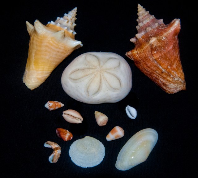
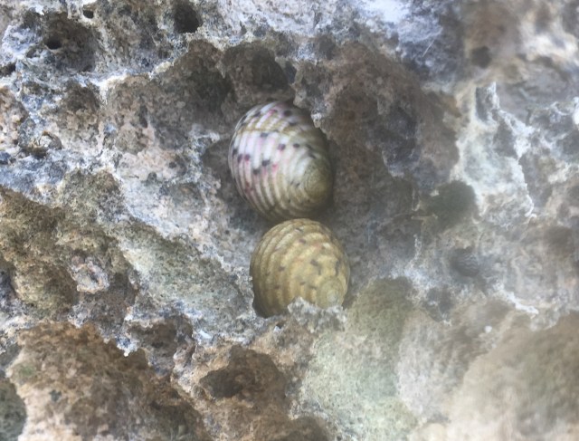
One of the highlights of this area is the shelling.  Since the beaches are pretty remote, with just a little effort you can find quite a collection in just a short time. The shoreline is covered with living shells from the high tide line on down.

IMG_1934

Various kinds of periwinkles hunker down in the sun waiting for the return of the tide.

IMG_9830

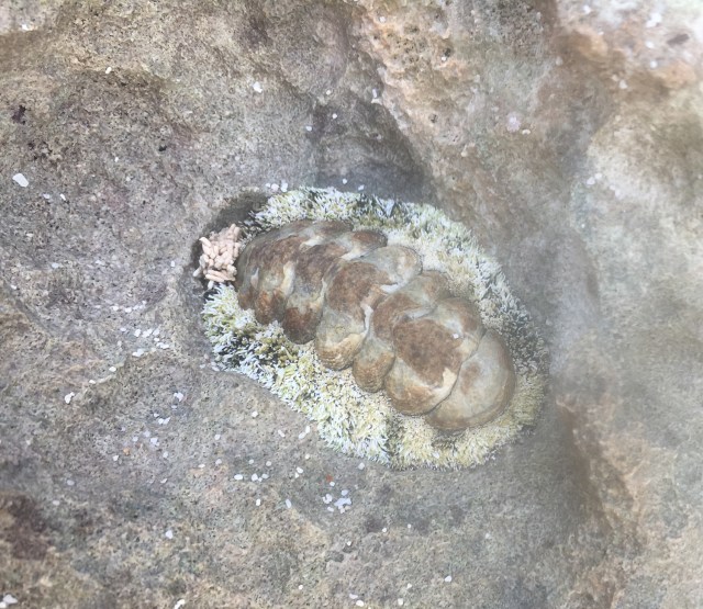
Large chitons are common.

Bisquit merge 1

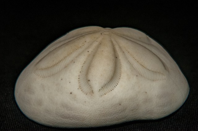
The shells of “sea biscuits” are everywhere.  A little bigger than a softball, they are half way between a sea urchin and a sand dollar. Unlike many sea urchins the shells of these guys are pretty sturdy, so they collect on the beach in significant numbers.

Shell1 merge

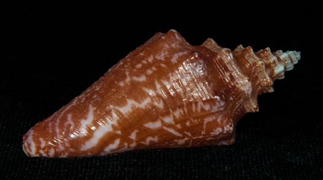
One of many…

_DSC3974

IMG_4898

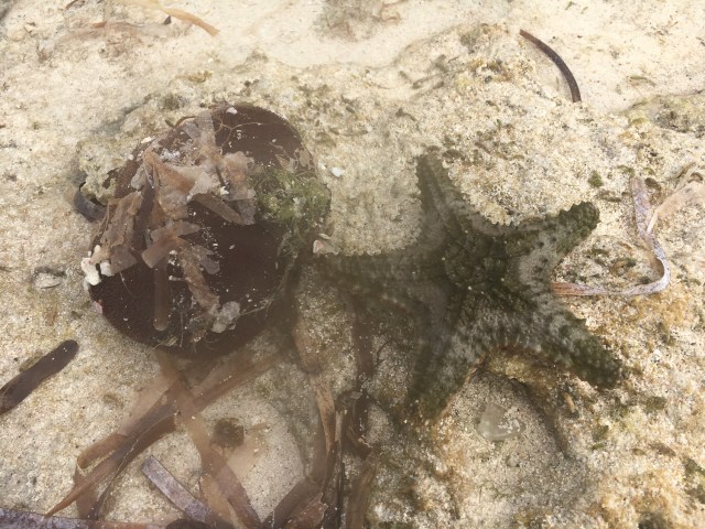
A live seabiscuit covered with his best attempt at camouflage, and starfish.

IMG_9990

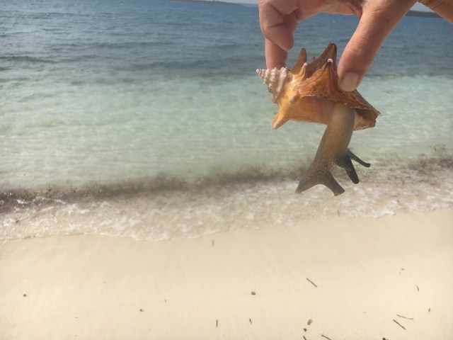
You don’t see a lot of living conch around here.  Here is a cute little baby…

Posted in Underway | 3 Comments

Breakers to the left! Breakers to the right!

Yesterday we got an early start from the anchorage off Sandy Point at the southeastern end of Great Abaco Island, and sailed around the southern end, and halfway up the east shore. It was a fast and boisterous sail, with winds of 20 to 25 knots and rather large seas for the 55 miles to our destination. The boat was moving at 7 to 9 knots for most of the trip. The Amel’s hard dodger did a great job at keeping us dry–ALMOST all the time–as we plowed through some of the waves instead of over them.

My original plan was to enter the lagoon on the east side of Abaco Island (know as the “Abaco Sea”) at Little Harbor Cut, but with a fairly large swell running that narrow, twisting, and fairly shallow entrance looked to be a bit more dangerous than I was comfortable with.  Instead, we headed a few miles further north to the North Bar Channel.  Wider, deeper, and straighter it was the better choice.

IMG_1199

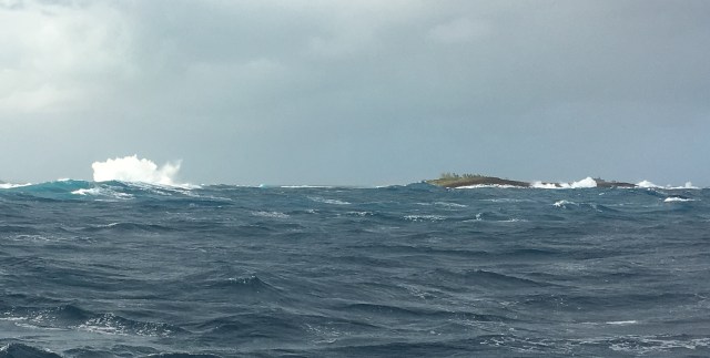
Viewed from offshore, it was a bit of a challenge to pick out the calm inlet from the surging breakers on all sides.  Spray was flying up from waves as they crashed on “Channel Rock. ”  The cruising guide had a very useful piece of advice about this rock, “Don’t hit it.” Thanks for that.

Although exciting to watch the surroundings, the actual inlet transit proved to be pretty tame.  We entered under sail on a strong flood tide, so the waves in the center of the channel were far apart and showed no tendency to break. Although just a few dozen yard to either side…

IMG_2069

Looking to the north side of the channel, we watched waves break on the rocky reef.

IMG_5323

On the south side was more rough water as waves broke over a wrecked construction barge–complete with backhoe!

We anchored in the lee of Lynyard Cay.  A weather front will pass with some rain and then we’ll be doing some more exploring.

Posted in Underway | Leave a comment

Pinned Down…

We are anchored off of Sandy Point, at the southern end of Great Abaco Island.  We arrived here just as the last frontal boundary moved out, and set up a pattern of strongly reenforced trade winds that have have been blowing at 20 to 25 knots and are forecast to be up to 30 knots forthe next 36 to 48 hours. This is not the very best place I would have picked to ride out a blow, but with the wind from the North and East, it won’t be bad. The biggest problem is that it is a bit too choppy to launch the dinghy without expecting a good salt water bath, so exploring on shore is on hold for the moment. We’ll be a bit stir-crazy after a few days cooped up!

We have lots of room around us, (we are the only boat here) the water is not too deep (8 to 10 feet), and there is good holding for the anchor in deep, clear sand. If the forecasts are right, we will have a short window to get out of here and run up the east shore of Great Abaco to Little Harbor on Monday which is better protected from more directions and we’ll have the opportunity to explore more.

Shortly after we arrived, Karen noticed a pair of barracuda that were cruising around the boat.  Just for fun, I threw a shiny fishing spoon out, and quickly had a strike.  I jumped him once, and lost him.  The next afternoon we saw them again.  I cast the same lure, and when he heard it splash in the water, he darted over to investigate. As soon as he got close enough to see what it was, he raced away as fast as he could.  He remembered…

Posted in Underway | Leave a comment

The Awesomeness That is a Blue Hole

I am poking about in the dinghy looking for good fishing water behind some of the small islands here around Great Harbor Cay.  Driving carefully in water less than 2 feet deep I  scan the bottom ahead looking for signs of feeding fish, when I see something I did not at first understand.  All around me is shallow sand covered in turtle grass, barely deep enough to float the dinghy. Ahead of me surrounded by white sand, is a dark patch on the water, and I can’t quite make out what it is.  As I approach, I realize I have stumbled upon one of the Bahamas’s famous “Blue Holes”.

Blue Holes are a signature geological feature in the Bahamas  Thousands of years ago, during the last ice age, sea level was hundreds of feet lower than it is today.  Rain water percolated down through the soft coral rock that makes up these islands, and dissolved some of it away to make large underground caves and caverns.  Fast forward several thousands of years, and the ocean level has risen, and some of those caves have collapsed. This results in a deep (sometimes a VERY deep) hole that, in the light colored shallow water of the Bahama Bank, stands out as a sudden, deep blue spot.  Some of these are famous among divers and snorkelers, others are uncharted and waiting to be “discovered”.  Since the one I found is not on the chart, I can without exaggeration  proclaim it to be “uncharted”.

This one is a true classic, almost perfectly round, about 150 feet across, it is clearly visible on a Google Earth satellite picture. So while it might not appear in the charts or guidebooks, it is not exactly hidden.

Screen Shot 2018-01-20 at 17.10.53

We took our portable sonar over to measure how deep it is, and the answer is: We don’t know; but deeper than 120 feet!  To put that in perspective, there is no other water on that satellite image over about 10 feet, and most of it is less than 5.

Snorkeling over the hole, shows, that yes, the bottom is far below what you can see, fading off into endless blueness.  And the sides are swarming with fish.

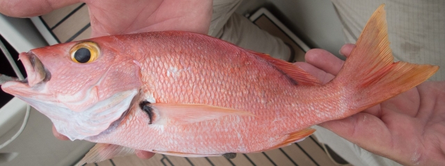
Blue Hole Frame grabI think i’ll be stopping back there tomorrow with fishing gear and seeing if I can grab a tasty fresh snapper for dinner.


Posted in Underway | Leave a comment

Great Harbor Cay

For waiting a few days at the dock in Freeport we were rewarded with 50 miles of fast  easy and fun sailing over to the Berry Islands and Bullocks Harbor on the back side of Great Harbor Cay. On an easy beam reach in 15 to 20 knots of wind we averaged over 8 knots.

Separating the Berry Islands from Freeport on Grand Bahama is the Northwest Providence Channel.  Like most passages between major island groups here, this is a deep water passage, water well over 1000 feet deep.  As we approach our destination, on the other hand, we have to navigate our way across about 5 miles of the Great Bahama Bank–decidedly NOT deep.  For about a mile we sailed in water less than 7.5 feet deep–sometimes less than 7–leaving a long trail of stirred up sand behind us.  We never actually touched bottom, but it was REALLY close.

We joined about a half dozen other boats here in Bullock Harbor, just west of Great Harbor Cay, and are looking forward to a few days of exploring and adventuring.  Hopefully we can get some photos worthy of posting for your interest!

Posted in Underway | Leave a comment

A Wet Crossing.

We untied from the docks at Bimini early this morning, and set out course for Grand Bahama Island, one of the major commercial and tourism locations in this country.  Mostly the passage was uneventful, except as Karen noted, it was a very “un-Caribbean” looking day.  Meaning… overcast gray skies and gray water.  The closer we got to our destination at the Grand Bahamas Yacht Club, the more the gray skies poured rain down on us.

I was hopefully that we would snag a wahoo on the run over here, but it was not to be.  We arrived–fishless at the yacht club at about 5, and just after we tied the last line to the dock, the heavens opened, for real.  It rained so hard, I am pretty sure if someone stood looking up at the sky they would have been at risk of drowning!

It’s an early night for us after a tiring day.  The weather for the next couple days looks like on-and-off showers.  Time to break out the umbrella!  We have a project to do while we are here:  find a fuse for one of our battery chargers that is on the fritz.  I am hoping that the fix will be that simple…

Posted in Underway | Leave a comment

Fast! Faster! Fastest!

Screen Shot 2018-01-06 at 11.16.57

Key West to Bimini.

Joining the 200 mile Club

We finished our passage from the anchorage at Key West to the dock here in North Bimini in record (for us!) time.  The actual over ground distance we covered was 201 nautical miles, and we did that in 22 1/2 hours for an average speed of 8.9 knots! Wow.

Even in a boat this size you can sail for a very long time and not do 200 miles in 24 hours.  Now, we did cheat a bit (OK, more than a bit) traveling with the Gulf Stream that gave us a push from behind of 2 knots for much of the trip, but we were on a fast reach almost all the way, and routinely saw speeds through the water of 8.5 to 9.5 knots.  That was the good news!

Now there is a saying with certain types of sailors, “Fast is fun!”  I am sure they mean it, but they were not with us on this trip.  The waves were not big, I doubt we ever saw any over 6 feet.  Certainly, not the biggest waves we have sailed in, but this was the least comfortable sea we have ever spent this many hours on.

Because of the fast current, the waves were short, steep, and seemed to come from all directions at once. Moving around the boat was a constant challenge to keep our footing. We could never predict which way it was going next. Both of us were seasick for at least part of the way, and that doesn’t happen often! For those of you who might routinely sail in San Francisco, imagine sailing in the washing machine of waves that is the Golden Gate on a strong ebb tide–for 18 hours…

Normally the AMEL hull shape is very “sea-kindly,” meaning it has a smooth, gentle motion through waves.  Normally.  On this run, about every 15 minutes or so we would come down off one wave, and crash into the next with a great thud, and water would pour across the deck.  Fortunately, we were warm and dry under the dodger, but it is not often we see green water pour over the dodger windows!

Surf to the Left of Me, Surf to the Right…

Arriving for the first time at the entrance to the harbor in North Bimini with significant surf running is… interesting.  You see on the chart where you are supposed to go, but what you see from offshore as you approach is a continuous line of breaking surf…  Screen Shot 2018-01-06 at 12.00.07

You have to run straight into what looks like a solid wall of breakers, then make a sharp left, just before you run up on shore, to run the channel behind the shallow bar where the waves are furiously churning. The chart tells you that all around is “Shifting sand” that you know has not been surveyed since well before Hurricane Irma stirred up these waters. Just to add to the fun, there is a powerful tidal current flowing in, so pretty much once we commit, there is no good way of turning back.

As we were circling, trying to make sure we understood what the chart and buoys were telling us, we had the good fortune to have a local tourist dive boat come out of the harbor.  Watching him gave us the confidence that the approach we were planning really was the correct one.

The final challenge was getting the boat into the marina slip, while fighting a current of 2 knots.  Even that came off without a problem, although I have to admit my first approach had to be aborted when I didn’t get the current judged quite right.

Welcome to the Bahamas, Mon!

Karen took our paperwork to customs and got us checked in.  We have our cruising permit, fishing license, and are good to stay in the Bahamas for the next three months.

Bimini is still a bit rough after the hurricane, many of the local businesses are still rebuilding, and lots of buildings are torn up, but basic services are functioning. Speaking of basic services, “Bailey the Lobsterman” came down the dock this morning and greeted us offering his wares.  A dozen fresh caught local lobster for:  $50. Good thing we have room in the freezer 🙂

Posted in Underway | Leave a comment

And, We’re Off!

As a huge and fast moving winter storm powers up the frozen Atlantic Coast of the USA, we are getting ready to hop on the back side wind of that same weather system to have a fast and easy ride from Key West to our planned landfall in Bimini, Bahamas.  We’ll be leaving tomorrow morning, and it looks to be a 20 hour trip, more or less.

Looking at the weather reports up and down the East Coast, we are REALLY glad to be far enough south that we are out of the cold.  This evening the US Coast Guard closed the entrance to Chesapeake Bay because of ICE!  They actually had cutters out along the Virginia shore on ice breaking duty.  Geez.  We were actually thinking about how chilly it was going to be on our sail tomorrow.  It might get down to 60ºF overnight!

Here are some pictures from around the island…

DSC_2141

Ibis (Ibises? Ibi?) are locally pretty common in open country across a lot of Florida..

DSC_2129

Non-native iguanas are very common in all the warmer parts of Florida.  Younger animals and females are green.  The mature males tend to be more flamboyant.

DSC_2113

Like the kid in the candy store!  Oh, wait… it IS a candy store!

DSC_2072_3_4_5_6_7_8_9_easyHDR

Interior battlements at Fort Taylor

DSC_2056

The parade ground at Fort Tylor

DSC_2050

Historic Fort Taylor on the southernmost part of Key West.

DSC_2040

The moat around Fort Taylor.

Posted in Underway | 1 Comment